


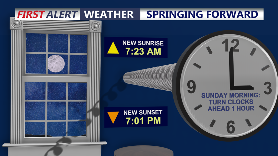


DELMARVA - The low clouds and fog have burned off for inland areas with temperatures in the 60s this afternoon, but only 40s at the coast. As a warm front moves through this evening, temperatures remain the upper 50s and lower 60s. Saturday night also marks the start of daylight saving time, so clocks should be set ahead one hour before bed. It is also a good time to check the batteries in smoke and carbon monoxide detectors.
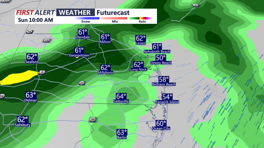
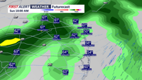
Late tonight into early Sunday, a weakening cold front moving in from the west may bring scattered showers and perhaps even a thunderstorm to parts of Delmarva, especially in the morning. The front is expected to weaken as it moves east, so rainfall coverage may end up more limited than widespread. Even so, a few passing showers remain possible into early Sunday.
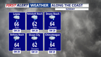
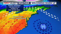
Warmer air continues to push northward through the weekend, helping erode the cooler air mass that has been stuck across the area. By Sunday and Monday, much of Delmarva will be sitting in a much milder pattern, with highs reaching the upper 60s to low 70s.
Early next week, springlike warmth takes hold across the peninsula as high pressure offshore and a south to southwest wind bring a warmer air mass into the region. Highs are expected to push into the low to mid 70s by Tuesday and Wednesday for many inland areas. Coastal locations may stay cooler at times, especially if a sea breeze develops and moves inland. Georgetown could come close to a record high on Wednesday.
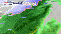
A cold front approaches the region on Thursday, and depending on its timing, some areas may not get as warm as currently expected. Behind that system, temperatures turn cooler again by later Thursday, though readings should still remain above average for this time of year.