


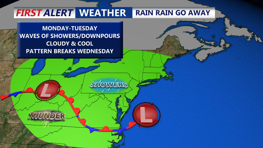


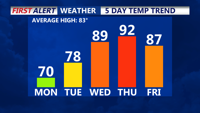


DELMARVA - A gloomy Monday continues across Delmarva as low pressure tracks along a stationary front draped over the Mid-Atlantic. Expect more of the same this afternoon with cloudy skies, occasional mist or drizzle, and scattered showers. While the timing and location of rainfall will be hit-or-miss, there is a 20 percent to 30 percent chance of rain throughout the day. Temperatures struggle to get out of the 60s. Some inland spots could hit 70 later today. A damp and cooler easterly wind will prevent temperatures from rising much this afternoon.

This evening remains cloudy, with areas of light rain and drizzle, with temperatures in the 60s.
Monday night, lows will settle in the mid 60s as another weak low approaches from the west. This will begin to lift the stationary boundary north as a warm front, but the full transition isn’t expected until Tuesday night.

Tuesday will bring gradual warming, with highs reaching the upper 70s to near 80 under mainly cloudy skies. Showers are likely again Tuesday night into Wednesday morning as the region sits in a transition zone between air masses. It remains mild and muggy with temperatures in the 60s.
By Wednesday, the warm front will be north of the area, ushering in a surge of warm and humid air from the south. High temperatures are forecast to climb into the mid to upper 80s across Delmarva. Several upper-level disturbances will bring the potential for scattered showers and thunderstorms throughout the day.
Thursday will mark the peak of the heat and humidity as a Bermuda high anchors offshore. Highs are expected to push into the upper 80s and low 90s, with dew points in the low 70s creating heat index values in the mid to upper 90s. Heat Advisories may be needed depending on how oppressive conditions become.

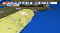
A strong cold front is expected to move through late Thursday, bringing the threat of afternoon and evening thunderstorms. Some storms could be severe, with the Storm Prediction Center placing parts of the Mid-Atlantic under a 15 percent risk for severe weather.
Cooler and more comfortable air moves in by Friday as high pressure builds from the north and west. While a passing upper trough could spark a few showers in northern areas, much of Delmarva should remain dry with highs in the low to mid-80s and lower humidity.
Summer officially arrives Friday night at 10:42 pm, marking the longest day of the year. It will feel like summer heading into the weekend.
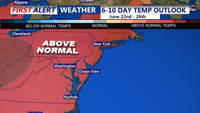
Sunny and pleasant weather is expected to continue into Saturday, with another potential cold front arriving Sunday. High temperatures will be in the 80s Saturday, then lower 90s Sunday. A bit cooler at the beaches.

As we look into the extend forecast, we could see our first heatwave of the summer season next week. A sustained period of highs in the 90s are expected early next week, along with muggy conditions.