



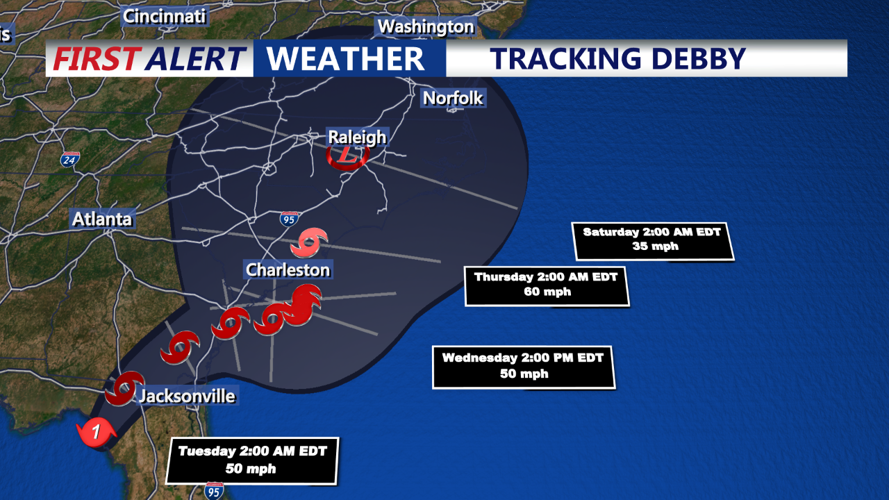
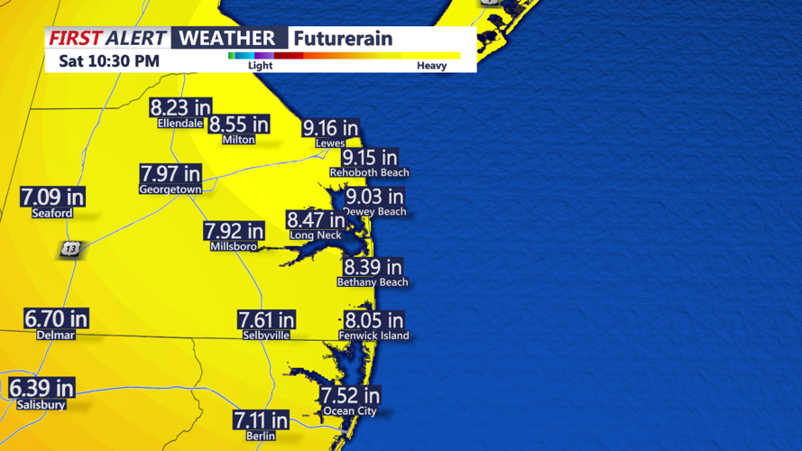

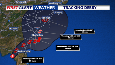
DELMARVA- Hurricane Debby made landfall this morning as a Category 1 hurricane around Horseshoe Beach, Florida. The remnants of Debby could affect Delmarva late week and into the weekend with heavy rain and wind.
For today and Tuesday we're looking at hot and humid conditions with temperatures topping out in the low 90s, with feels like temperatures in the mid to upper 90s. Tonight mild and muggy conditions with lows in the mid 70s.
Later Tuesday a cold front with an upper trough approaches from the north and west. Southerly winds will bring tropical moisture northward, showers and thunderstorms are expected to develop ahead of the cold front from mid-late afternoon, continuing through the night. While severe weather is not highly likely, any strong storms could cause localized strong downbursts and damaging wind gusts.
Tuesday night will be mainly dry, mild, and muggy with lows in the low 70s.
The cold front is expected to pass through the area by Wednesday morning before stalling over the Mid-Atlantic region. Attention will then shift to Tropical Storm Debby currently over northern Florida.
The forecast for Debby is still uncertain, but it is expected to meander in the Southeast for a few days before potentially moving northward. This situation will likely bring waves of tropical moisture and precipitation to our region from Wednesday through Saturday. Temperatures will cool into the low to mid 80s, with the potential for drier weather returning by Sunday.

Stay with the First Alert Weather team for updates as the situation develops, especially regarding the impacts of Debby.
