


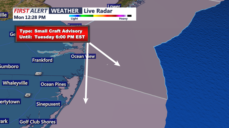


DELMARVA - As of Monday evening, Arctic air continues to pour into the region, accompanied by gusty winds. An upper-level trough extending from the Canadian Maritimes westward across southern Canada is contributing to strong zonal flow, facilitating cold air advection. This setup is resulting in deep vertical mixing, with 925 mb winds around 40 knots. While there has been a notable downward trend in wind speeds this afternoon, gusts remain significant, and a notable breeze is expected to persist through the night. Wind chills are projected to drop into the single digits, with areas north and west of I-95 experiencing temperatures near or below zero. The Pocono region may see wind chills as low as -15°F, prompting a Cold Weather Advisory for Carbon and Monroe counties.
On Tuesday, the synoptic setup remains similar, with continued zonal flow across the area. The pressure gradient is expected to weaken slightly, but a gusty breeze will persist due to ongoing cold air advection and decent mixing heights. Winds are anticipated to be sustained at 15-20 mph, with gusts ranging from 25-35 mph, diminishing later in the afternoon. Temperatures will remain cold, with most areas struggling to rise above freezing. Afternoon wind chills are expected to stay in the teens, with single digits to near zero along the I-80 corridor. The Cold Weather Advisory for Carbon and Monroe counties extends until 10 AM Tuesday.
High pressure will remain over the area Tuesday night, maintaining well below normal temperatures. Winds averaging 10 to 15 mph, with gusts up to 20 mph, will contribute to continued cold conditions. Overnight lows are forecasted to be in the single digits in the southern Poconos and far northwest New Jersey, and in the teens elsewhere. Wind chill values could drop as low as -15°F in higher elevations, with single digits expected in other areas.
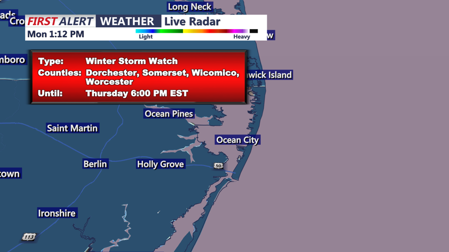
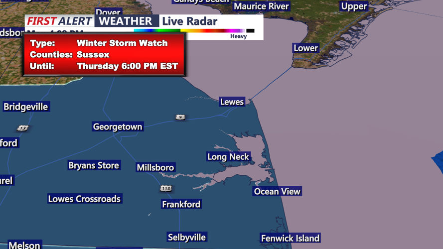
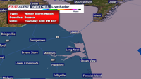
By Wednesday morning, high pressure will move offshore as a closed H5 low dives into the Midwest, carving out an upper trough extending into the Gulf Coast states. Surface low pressure is expected to develop ahead of this trough, lifting toward the Mid-Atlantic region by Wednesday night. Current model trends suggest the low will track south and east of New Jersey, resulting in the bulk of snowfall affecting southern Delaware and the eastern shores of Maryland, with minimal accumulations anticipated for the majority of the forecast area. The low is projected to be off the Virginia-North Carolina coast late Wednesday night, moving approximately 350 to 400 miles east of Atlantic City by Thursday afternoon.
Snowfall accumulations from Wednesday afternoon through Thursday are expected to be less than an inch over the southern Poconos, northern New Jersey, and the Lehigh Valley down to the I-95 corridor. The Delaware Valley, most of southern New Jersey, and coastal New Jersey may see 1 to 2 inches. Southern portions of the eastern shores of Maryland, southern Delaware, and extreme southeast New Jersey could receive 2 to 4 inches, with up to 5 inches possible in parts of southern Delaware.
