


DELMARVA - A First Alert Weather Day has been issued for Delmarva for Sunday afternoon into early Monday morning. A powerful nor’easter will bring Delmarva heavy rain, strong winds, coastal flooding, and beach erosion.
The rain will arrive here along the coast during the midday hours of Sunday. Initially, the rain will be in the form of scattered light rain showers. These rain showers will slowly become more widespread as the day progresses.
By mid to late afternoon, the rain will become much more widespread and intense. Heavy rain will continue for hours, stretching all the way into the overnight hours of Sunday. It is during this time that the biggest concern for flooding on area roadways will be. The best advice would be to stay home, if possible, overnight Sunday.
The rain will not taper off until midday Monday. Some lingering flooding could be a problem during Monday mornings commute.

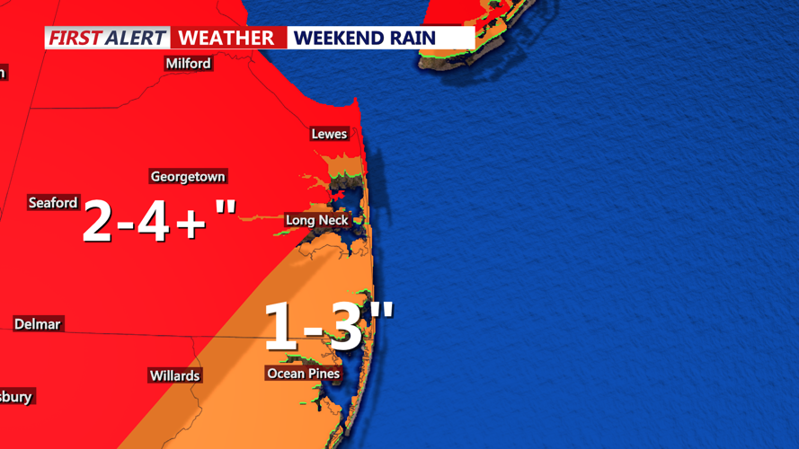
Expected rainfall between Sunday 12/17 through Monday 12/18.
Rainfall totals will be significant, adding up to 2-4 inches in many locations. Some localized areas on Delmarva will see totals exceed 4 inches of rain. Rainfall totals in this range will be capable of flooding roadways. Be sure to use caution while traveling as hydroplaning can become an issue even on non-flooded roads.

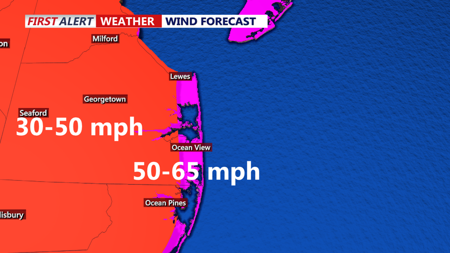
Peak wind gusts expected Sunday evening.
Rain will not be the only factor Delmarva has to contend with. Wind gusts will increase to between 40-50 miles per hour Sunday evening. Winds could gust as high as 65 miles per hour at the beaches Sunday night. With a saturated ground and strong winds, some trees and limbs could be brought down. There will be a possibility of power outages Sunday evening and night. The winds will continue to gust as high as 40 miles per hour during the daytime hours of Monday.

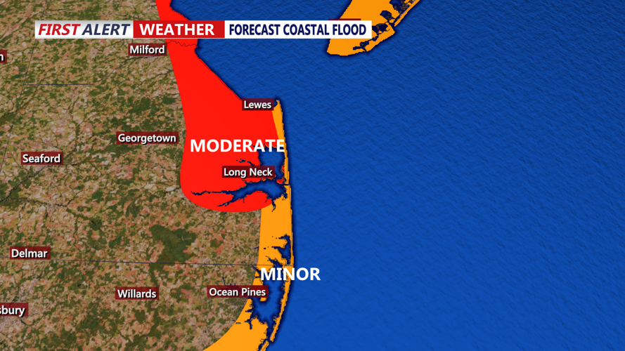
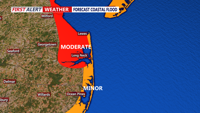
Expected coastal flood levels during Sunday PM and Monday AM high tide cycles.
There will also be coastal impacts with this storm system as it barrels up the coast. The strong onshore flow out ahead of this storm will result in higher water levels for Sunday evening and Monday mornings high tide cycles. Minor to moderate coastal flooding will be expected near all area tidal waterways. The worst flooding will occur on the Delaware Bay, Chesapeake Bay, and inland bays. The coastal flooding will not be the only issue as surf will become dangerous due to the strong winds. Waves as high as 15 feet onshore could result in significant beach erosion Sunday night.
Be sure to stay tuned to CoastTV or download the CoastTV weather app for more updates on the weather throughout the day ahead.