




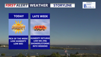
Delmarva is enjoying sunny, comfortable weather today thanks to high pressure moving into the region. Humidity stays low with highs in the upper 70s to low 80s, but hotter and more humid conditions return by Friday along with renewed thunderstorm chances that may linger into the start of the weekend.
From
To

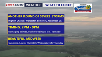
Warm, muggy weather continues across Delmarva today as a cold front approaches. Showers and storms are expected this afternoon into the early evening, with damaging winds as the main concern. An isolated tornado and flash flooding cannot be ruled out, especially in southern Delmarva. Quieter, sunnier weather arrives Wednesday and Thursday before heat, humidity, and more storm chances return late this week.

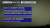
Delmarva faces a hot, humid and windy day with a risk for severe thunderstorms late this afternoon into tonight. Damaging winds, heavy rainfall, flash flooding and an isolated tornado are possible, with the greatest concern between roughly 5 p.m. and 11 p.m. A high rip current risk is also in place from Ocean City to Chincoteague.

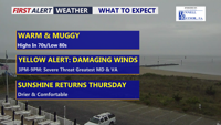
Delmarva has one more unsettled day ahead as a cold front approaches from the northwest. A Yellow Alert is in place for the threat of strong to severe thunderstorms this afternoon into early evening, with damaging wind gusts the main concern. Drier, more comfortable weather returns Thursday through the weekend.

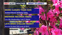
Delmarva starts the week on a warm and breezy note as a warm front lifts through the region, sending temperatures near 70 today and close to 80 Tuesday. Even warmer air builds in Wednesday, with record highs potentially challenged inland before a cold front brings the chance for afternoon and evening showers and thunderstorms. That front may stall nearby, keeping the weather unsettled through the weekend with periodic shower chances, but no day looks like a washout.

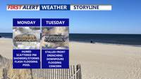
Delmarva will experience warm, humid conditions with a daily risk of showers and storms. Fog and mist are likely to start the day, especially along the coast. A cold front arriving late Monday will trigger scattered thunderstorms and downpours into the evening. This front is expected to stall through midweek, sustaining unsettled weather with periods of heavy rain, though the severe threat remains low. Can't rule out the possibility of flash flooding. By late week, heat and humidity will intensify, pushing heat index values toward 100 degrees before another cold front approaches.

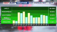
Sunday will deliver more summer warmth across Delmarva with highs in the 80s and only isolated thunderstorm chances. However, a cold front approaching Sunday night will trigger scattered showers and thunderstorms into early next week, followed by additional unsettled weather as stalled fronts linger and another system nears by the weekend.

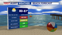
Sunday will bring another warm, humid day across Delmarva, with highs in the 80s and mostly dry skies. However, a cold front approaching Sunday night will trigger rounds of showers and thunderstorms through midweek, followed by more unsettled weather late in the week as another front arrives.