





Temperatures near 100 degrees and heat index values as high as 109 will make Wednesday dangerously hot before Canadian wildfire smoke spreads across Delmarva.
From
To


Near-record heat and dangerous humidity will dominate Delmarva today and through the Fourth of July weekend, with storm chances gradually increasing.

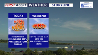
Delmarva will face another day of near-record heat, high humidity, and a slight risk for severe thunderstorms today. A cold front moving through tonight will bring a more comfortable weekend, though another round of showers and storms could return late Sunday into Sunday night.


Delmarva will see one more hot and humid day today, with inland highs in the mid 90s and a third straight 90-degree day marking a heat wave. A strong cold front will bring showers and isolated severe thunderstorms late this afternoon and evening, followed by a much cooler, unsettled pattern through the end of the week and Memorial Day weekend.


Delmarva is heading into a stretch of summer-like heat beginning today, with highs climbing into the low to mid 90s inland and cooler 70s and 80s at the beaches. Near-record temperatures are possible through Wednesday before a cold front brings showers, storms and more seasonable air late week.

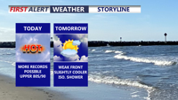
Today marks the third straight day of record-setting heat potential across Delmarva, with highs reaching the upper 80s to around 90 under partly cloudy skies. Dry air, gusty southwest winds, and ongoing drought conditions will also create an elevated fire weather risk. A weak front brings only slight cooling Friday, while a sharper cooldown arrives over the weekend with much-needed rain late Saturday night into Sunday. Early next week turns significantly cooler, with frost or even freeze conditions possible by Monday night into Tuesday morning before temperatures rebound by midweek.


Today brings unseasonably warm weather to Delmarva with highs in the mid 80s under mostly sunny skies, though areas near the bay and ocean will stay a bit cooler in the upper 70s to low 80s. Georgetown and Salisbury could come close to their daily record highs of 87 degrees. The warmth continues tonight and intensifies Wednesday, when record highs are likely as temperatures approach 90. Conditions stay well above normal through the weekend before shower and thunderstorm chances return Sunday ahead of a strong cold front. Much cooler air arrives next week with highs falling back into the 50s and 60s.