


DELMARVA -- The peninsula is locked into a dangerous stretch of heat and humidity as a strong ridge of high pressure remains in control across the Mid-Atlantic.
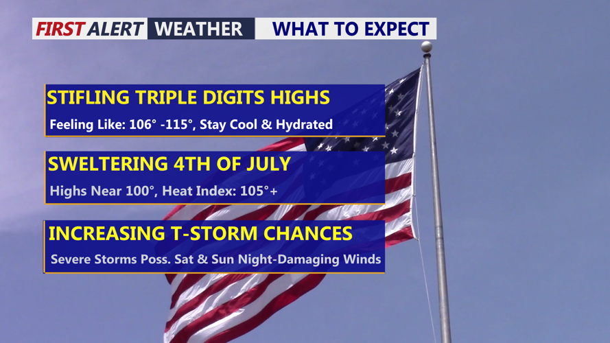
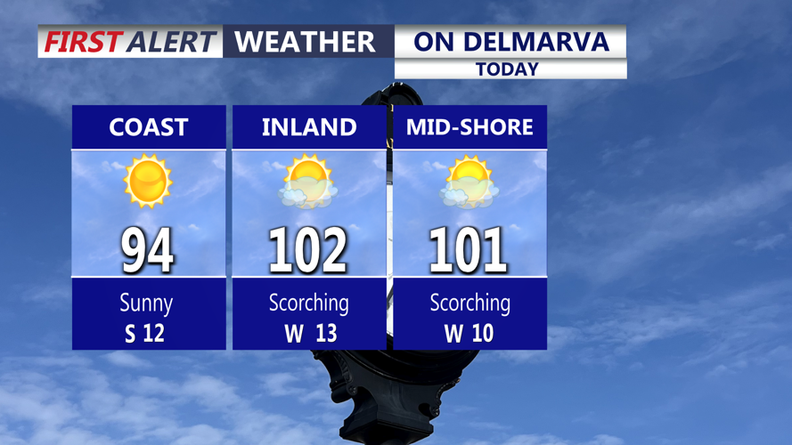
Highs today will surge into the upper 90s to near 104 inland, with beach towns also turning very hot, reaching the upper 80s to upper 90s. The humidity will make it feel even hotter, with heat index values climbing between 106 and 115 degrees. Georgetown’s record high for today is 101 degrees, set in 1954, and that mark could be challenged.

High in the low 100s, even hot at the beaches today.
Most of Delmarva will stay dry today, though an isolated storm cannot be ruled out late this afternoon or tonight. The best chance for stronger storms remains north of the peninsula, but any storm that develops could produce damaging winds. Tonight will stay very warm and muggy under mainly clear skies, with lows only falling to around 80 degrees.
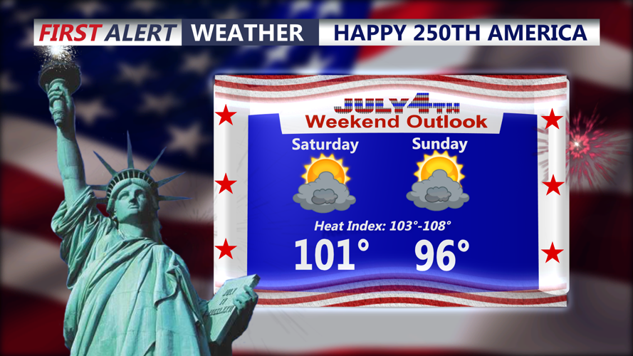
The Fourth of July will bring another sizzling day across Delmarva. Highs will climb to around 101 degrees inland, with heat index values making it feel like 103 to 108. Georgetown’s record high for Independence Day is 100 degrees, set in 1966, and that record may also be in jeopardy.

Sizzling weekend ahead, feeling like over 105, increase storms over the weekend, some of which could be severe with damaging winds.
The heat ridge will begin to weaken later Saturday and especially Sunday, allowing more disturbances to move into the region. That will bring increasing chances for afternoon and evening showers and thunderstorms through the holiday weekend.
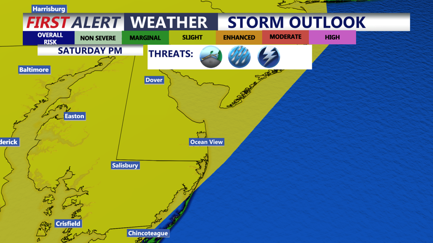
Storm coverage should be more scattered Saturday, then become more widespread Sunday into Monday. Damaging winds will be the main concern with any stronger storms, and holiday plans across Delmarva could be interrupted by both extreme heat and thunderstorms. The Storm Prediction Center has a SLIGHT risk 2 out of 5 for the threat of severe storms both Saturday and Sunday late afternoon-evening.

Slight risk for severe storms Saturday late afternoon-evening, damaging winds/downbursts are the primary threats.
A cold front will move through Sunday, then may stall near or just south of Delmarva. That setup will keep scattered to widespread showers and storms possible Sunday night through Monday night, followed by daily chances for isolated afternoon storms into the middle of next week.
