


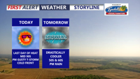
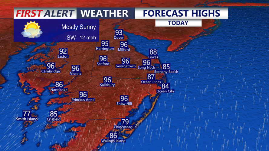


DELMARVA -- Today will be the last and final hot, humid day for Delmarva before a major pattern change arrives. Inland areas and the Mid-Shore will climb into the mid 90s, while beaches stay cooler in the mid to upper 80s. Southwest winds may gust between 25 and 30 mph at times.

Last day of heat and humidity, near record highs possible for Georgetown.
This will mark the third straight day of 90-degree heat across parts of Delmarva, officially making it a heat wave. Temperatures may also come close to tying or breaking the record high in Georgetown, where the record for today is 95 degrees, set back in 1962.
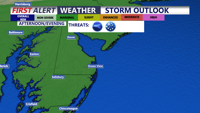
A strong cold front will move into the region this afternoon and evening, bringing showers and thunderstorms. The Storm Prediction Center has placed the area under a Marginal Risk, level 1 out of 5, for severe storms late today. The overall threat is isolated, with the best chance for stronger storms across northern Delmarva and areas just west of the peninsula.

Marginal risk (1 out of 5) for an isolated severe thunderstorm late this afternoon-evening, damaging winds & large hail are the primary threats.
Any storms that do develop could produce damaging wind gusts and hail. The hot and humid air mass in place will help create enough instability for thunderstorms, but lower wind shear may limit how organized the storms become. Still, stronger storm cores could produce locally strong to damaging winds, especially with downbursts.
Rainfall totals will generally range from one-tenth to one-half inch, though locally higher amounts are possible in stronger showers and thunderstorms. Most thunderstorms should end by late this evening, though a few showers may linger behind the front overnight. Temperatures tonight will fall into the mid 60s under mostly cloudy skies.

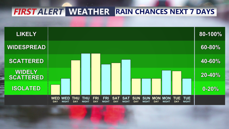
Isolated thunderstorms this evening, scattered shower threat persists into the weekend.
A dramatic change arrives Thursday. High temperatures will likely occur shortly after midnight, then temperatures will fall into the 50s through the afternoon. Scattered showers are expected to develop late Thursday and continue into Friday morning.
The end of the week and Memorial Day weekend will be significantly cooler and unsettled. The front is expected to stall south of Delmarva, while several waves of energy move along and north of it. This will bring multiple rounds of showers to the region.
A more organized area of low pressure to the west may increase rain chances later Friday into Saturday. With cool air wedging in from high pressure to the northeast and deep moisture in place, Saturday may bring periods of heavier rain. There is at least a marginal chance for excessive rainfall, especially if the stalled boundary becomes more active.
Temperatures will remain much cooler Thursday through Saturday due to northeast flow and repeated rounds of showers. Struggling to get out of the 50s and 60s. Some warming is possible Sunday into Memorial Day, but the pattern will remain active, with additional showers still possible. While the timing is not ideal for the holiday weekend, Delmarva continues to need rain as long-term drought conditions persist.
