


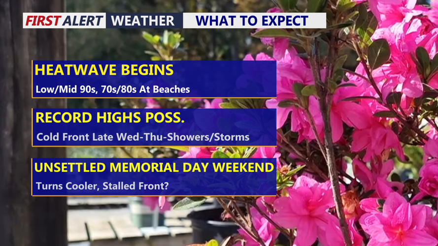

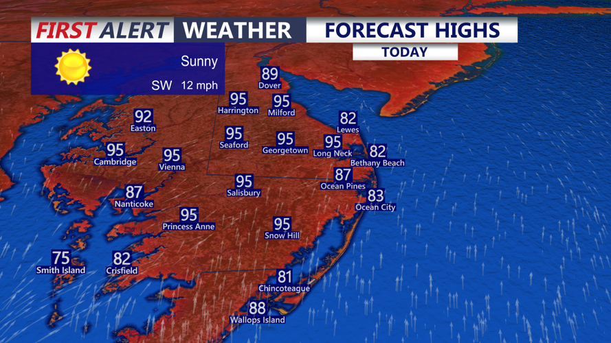


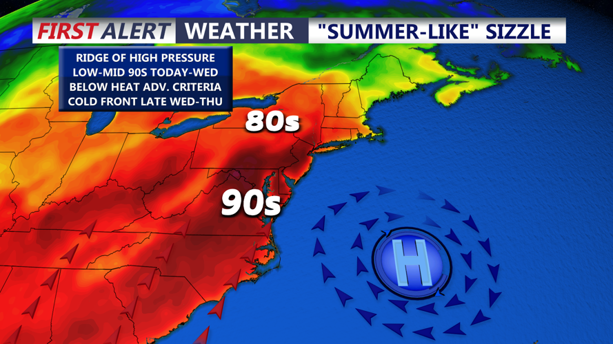


DELMARVA -- Today marks the start of a very hot stretch across Delmarva as an early taste of summer ramps up across the region. High pressure offshore and a strong upper-level ridge over the East Coast will help drive temperatures well above normal, with inland highs reaching the low to mid 90s under sunny, dry skies.

Low to mid 90s through much of the peninsula, 70s and 80s at the beaches.
The beaches will stay cooler, with temperatures mainly in the 70s and 80s thanks to a southerly flow off the water. Winds will come from the south at 5 to 10 mph, with a few gusts near the coast reaching up to 30 mph at times.
Record heat will be possible over the next few days. The record high for Georgetown today is 91 degrees, set in 1974. Tuesday’s record is 96 degrees, set in 1962, and Wednesday’s record is 95 degrees, also set in 1962. Delmarva could come close to those numbers as the heat peaks during the first half of the week.

Record highs likely today and coming close to records Tuesday and Wednesday.
Tonight will stay mostly clear and warm, with lows only falling into the upper 60s to low 70s. Tuesday will be mostly sunny and hot again, with highs reaching the mid 90s inland. Humidity will begin to creep up, especially by Wednesday, making it feel even more summer-like.

High pressure keeps us locked in the heat and humidity through Wednesday.
Wednesday is expected to be the last 90-degree day in this stretch before a cold front approaches Delmarva. That front will bring the chance for showers and thunderstorms from Wednesday night into Thursday. There is still some uncertainty with the timing, but if the front moves through during the day Wednesday, stronger storms could be possible due to the amount of instability in place.
The front may linger nearby or just south of Delmarva on Thursday, keeping additional showers in the forecast while temperatures ease closer to normal. By the end of the week and into Memorial Day Weekend, the pattern looks more unsettled, with more opportunities for showers and storms across the peninsula as a front potentially stalls out over the region.
