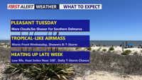
Delmarva will enjoy slightly lower humidity Tuesday before showers, thunderstorms and increasingly hot conditions return later this week.
Delmarva will enjoy slightly lower humidity Tuesday before showers, thunderstorms and increasingly hot conditions return later this week.
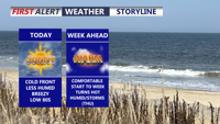
Delmarva will enjoy a pleasant start to the week with seasonable temperatures, lower humidity, and mainly sunny to partly cloudy skies through Tuesday. Minor coastal flooding is expected again with Monday evening’s high tide along the Atlantic coast and Delaware Bay. Heat and humidity return by midweek, with a chance for severe thunderstorms Thursday afternoon and evening before a fantastic Father’s Day weekend settles in.
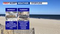
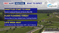
Delmarva will experience warm, humid conditions with a daily risk of showers and storms. Fog and mist are likely to start the day, especially along the coast. A cold front arriving late Monday will trigger scattered thunderstorms and downpours into the evening. This front is expected to stall through midweek, sustaining unsettled weather with periods of heavy rain, though the severe threat remains low. Can't rule out the possibility of flash flooding. By late week, heat and humidity will intensify, pushing heat index values toward 100 degrees before another cold front approaches.
Delmarva will experience humid, foggy nights and a stretch of unsettled weather through midweek. Beginning Sunday night, areas of mist and patchy fog will develop, especially along the coast. A cold front approaching late Monday will trigger showers and thunderstorms, with the primary concern being heavy rain and flash flooding. While the severe thunderstorm risk is low, locally gusty winds cannot be ruled out. The front is expected to stall through Wednesday, keeping rain chances high before heat and humidity surge again later in the week.
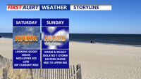
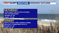
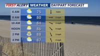
Saturday afternoon will kick off a stretch of warm and muggy weather across Delmarva, with partly sunny skies and highs in the 80s. While most of the region should stay dry this weekend, low clouds and patchy fog will return overnight, and a few isolated thunderstorms are possible Sunday over the Eastern Shore. By Monday, an approaching cold front will bring more widespread showers and storms. Temperatures will remain above normal into late next week, with heat indices potentially nearing 100 degrees.
A stretch of warm and humid weather will settle over Delmarva through the weekend and into next week. Saturday and Sunday will bring partly sunny skies and temperatures climbing into the 80s, with low clouds and morning fog each day. While most of the region should stay dry through Sunday, a stronger cold front arriving late Monday is expected to trigger more widespread showers and thunderstorms. Highs will remain above normal all week, and heat indices may approach 100 degrees in some locations by midweek.
A persistent warm and muggy pattern will continue over Delmarva through early next week, bringing periods of low clouds and patchy fog overnight, with daytime highs in the 80s. While the weekend should remain mostly dry aside from isolated inland storms, a cold front approaching Monday will trigger more widespread showers and thunderstorms. Temperatures will stay above normal into midweek, with heat indices nearing 100 degrees in some locations.
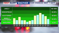
A stalled front lingering over the Delmarva Peninsula will keep the region humid through the weekend, with occasional showers and storms. Although conditions will ease somewhat compared to midweek, isolated flash flooding and strong wind gusts remain possible. A stronger cold front will arrive early next week, bringing more widespread storms and a gradual drying trend.
A stalled front over Delmarva Sunday will trigger heat and isolated storms to start the week. By Tuesday, a stronger cold front will bring the chance of severe thunderstorms. High pressure then builds in midweek, setting up lower humidity and comfortable weather heading into the Fourth of July holiday weekend.
A surge of heat and humidity as a warm front lifts north, pushing temperatures to around 90 degrees with heat indices topping 100 in spots. Isolated storms could develop in the afternoon and evening, with a cold front stalling nearby Sunday and briefly easing humidity. Another warm front Monday will keep conditions warm and unsettled before a stronger cold front crosses the region Tuesday, bringing a renewed risk of thunderstorms. High pressure will build midweek, delivering drier and more comfortable weather.