



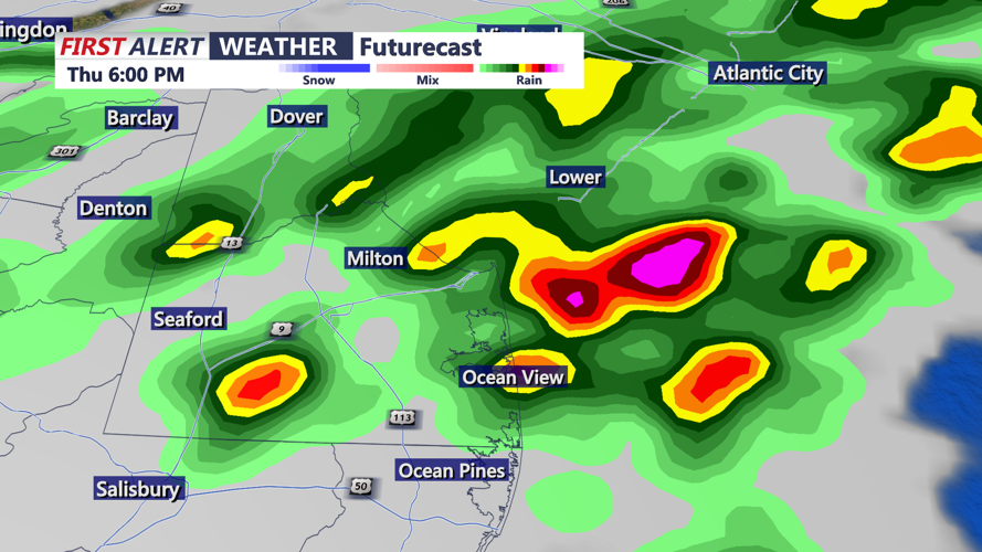
DELMARVA -- Thursday will bring another humid and unsettled day across Delmarva as a slow-moving frontal boundary wavers over the Mid-Atlantic. While the front remains nearby, weaker upper-level support and extensive cloud cover are expected to limit storm intensity compared to previous days. The Storm Prediction Center have issued only a general thunder outlook for the region, with the Weather Prediction Center lowering excessive rainfall concerns to a marginal risk. Even so, there is still the threat for isolated flash flooding or a stray strong wind gust.

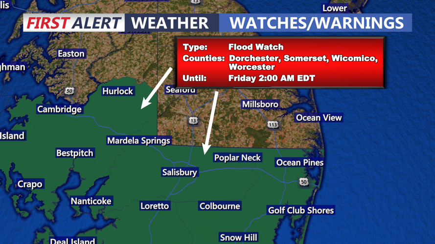
Flood Watch until 2AM Friday for Dorchester, Somerset, Wicomico and Worcester counties.
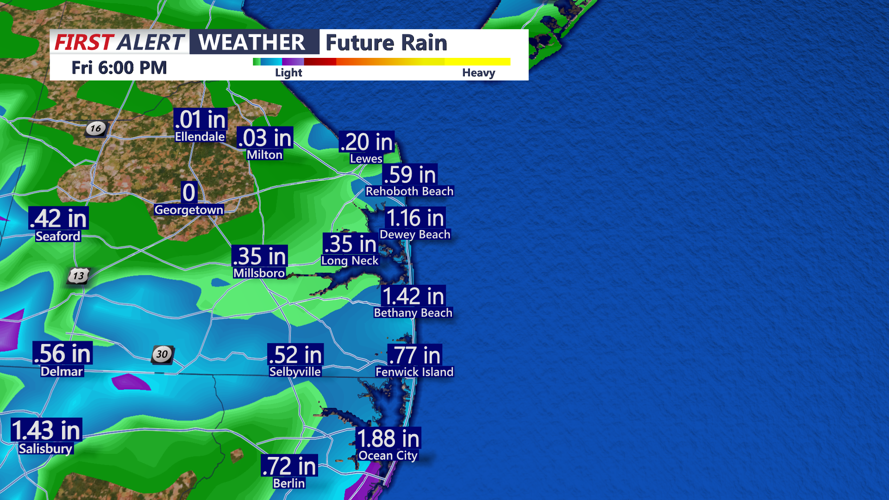
We do have an active Flood Watch up until 2AM Friday for, Dorchester, Wicomico, Somerset and Worcester counties, this area could see some training showers and storms through the evening.

Few scattered showers and storms this afternoon into the evening.
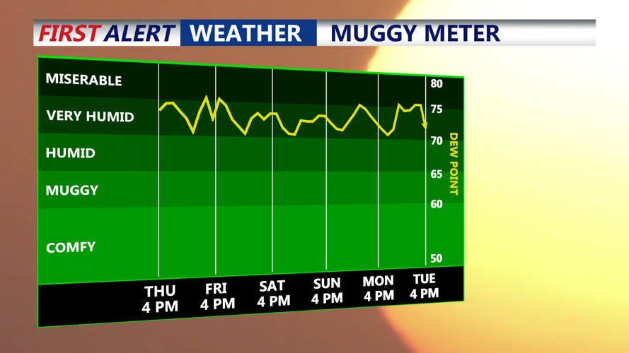
High temperatures will generally reach the low to mid-80s, but dew points hovering in the 70s will keep conditions feeling muggy, if not quite as oppressive as earlier in the week. As the sun sets, lingering showers and storms are expected to diminish quickly. Once clouds begin to clear, patchy fog could develop overnight, with lows settling near 70 degrees.

Some areas could see up to 2" especially southern portions of the peninsula through Friday afternoon.
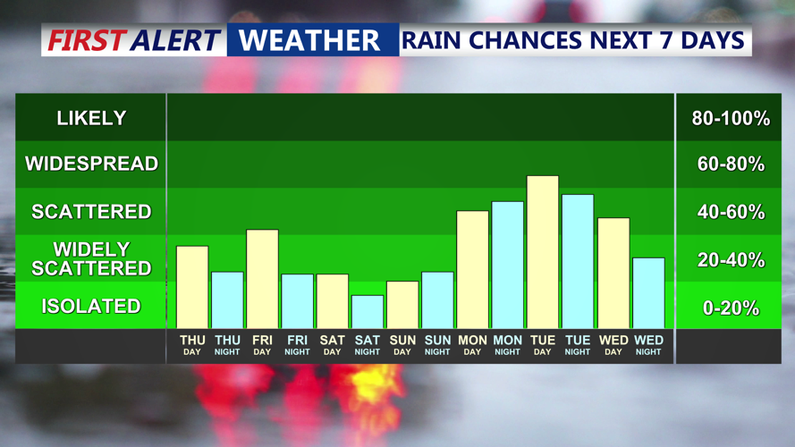
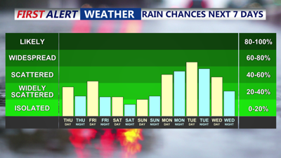
From Friday through Saturday night, the stalled front will weaken further. With less forcing aloft and only modest afternoon heating, thunderstorms should become more scattered and mainly develop inland, away from the cooler marine influence. A bit more sunshine could nudge daytime highs back toward the upper 80s to near 90 degrees in the warmest locations, with heat indices possibly approaching 100. Overnight lows will stay around 70, offering little relief from the humidity.
The weather pattern will shift again on Sunday as a stronger cold front approaches from the northwest. This system will bring better chances for more organized afternoon and evening thunderstorms, along with a higher risk of localized flooding and stronger wind gusts. The front is expected to pass through the area on Monday, delivering the greatest potential for widespread rainfall and a modest drop in temperatures.

Behind the front, high pressure building southeast from Canada should briefly bring a drier stretch by Tuesday and Wednesday. Still, the summertime pattern will linger, with highs rebounding to the upper 80s or near 90 and the possibility of spotty afternoon storms returning. Overnight lows are forecast to remain near 70 degrees through the middle of next week.


