


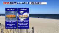


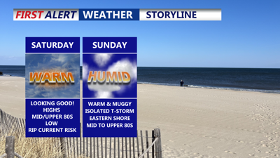
DELMARVA -- Saturday will begin with patches of morning fog or low clouds, especially along the coast and near rivers and creeks. As the day progresses, skies will become partly cloudy, and temperatures will climb into the mid to upper 80s inland, with cooler readings in the low to mid 80s at the beaches. Humidity will remain high, making it feel warmer. A light onshore breeze will keep the rip current risk low along the oceanfront. Thunderstorms should stay west of the peninsula through the day, leaving most outdoor plans in good shape.

Some fog to start gives way to a partly cloudy day with highs in the mid to upper 80s.
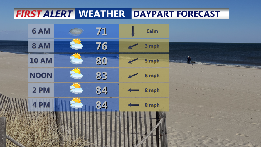
Cloud cover will gradually increase again overnight, and the combination of moist air and light winds will promote the redevelopment of low clouds or patchy fog. Temperatures will stay mild, with lows mainly in the low 70s.

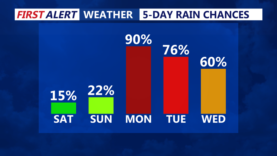
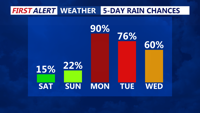
Weekend stays dry, better chances of widespread showers and storms moves back into the area Monday afternoon-evening.
Sunday’s weather will look similar to Saturday, with partly sunny skies and highs reaching the mid to upper 80s. Humid conditions will persist across the region. An isolated thunderstorm is possible over the Eastern Shore and areas west of Route 13, but most of the coastal communities are expected to remain dry. The highest chance for any stronger storms will stay north and west of Delmarva.
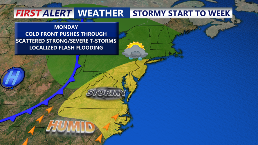
Changes begin on Monday as an upper-level trough approaches from the west. While this system will weaken as it nears the area, it will bring stronger daytime heating and more favorable conditions for showers and thunderstorms to develop. The risk for severe storms is not expected to be significant, but a few stronger cells with gusty winds or heavy rainfall with the threat of flash flooding cannot be ruled out in the afternoon and evening. Thunderstorm coverage will be more widespread compared to the weekend, with rain chances in the 60–80% range. Temperatures will hold in the 80s, with overnight lows dropping into the upper 60s and 70s as a cold front crosses the region late Monday night.

Cold front Monday brings the threat of scattered showers and storms, some gusty storms.
Forecast uncertainty increases after Tuesday as the cold front slows and stalls near or just south of the area. Lingering surface boundaries may help spark isolated showers and thunderstorms again Tuesday afternoon. By mid to late week, Canadian high pressure is forecast to build over the Northeast and Mid-Atlantic, likely suppressing widespread storm activity and bringing drier weather. However, given the persistent humid airmass and typical July heating, occasional afternoon storms can still pop up, especially near any lingering frontal boundaries.
Temperatures will stay slightly above normal through late week, with daily highs in the upper 80s to near 90 degrees. Combined with high humidity, heat indices could approach or exceed 100 in some locations.