


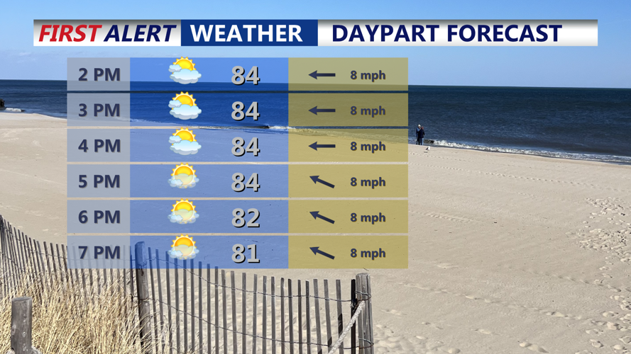


DELMARVA -- Saturday afternoon will feature partly cloudy skies, humid air, and temperatures rising into the mid to upper 80s inland and the low to mid 80s near the coast. The rip current risk along the Atlantic beaches will remain low, making for a good afternoon to enjoy the shore. Thunderstorm activity will stay mainly west of the peninsula through the evening hours, keeping most of Delmarva dry.
As night falls, mild temperatures in the low 70s will settle in, and a combination of light onshore breezes and a moisture-rich airmass will allow low clouds or patches of fog to redevelop, especially closer to the water.

Saturday look for warm and humid conditions, Sunday will be a carbon copy of today.
Sunday will bring similar weather, with partly sunny skies and muggy conditions continuing across the region. Highs will again climb into the mid to upper 80s. Most of the area should remain rain-free, but there is a slight chance of an isolated thunderstorm, mainly over the Eastern Shore and areas west of Route 13. The primary threat for stronger storms Sunday will remain north and west of Delmarva.
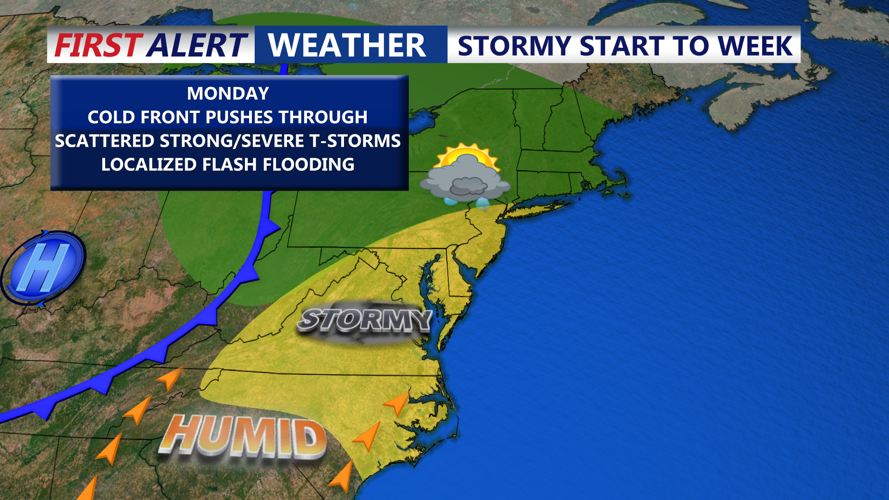
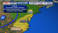
More active weather returns Monday as an upper-level trough moves into the Eastern U.S. Although this system will be weakening as it approaches, the combination of daytime heating and modest atmospheric forcing will trigger more widespread showers and thunderstorms. Rain chances will increase through the day, with the highest coverage expected from the afternoon into Monday night as a cold front crosses the region. While the severe weather threat appears limited, a few strong storms with gusty winds or heavy rainfall are possible. Highs Monday will remain in the 80s, with overnight lows dipping into the 60s and 70s.

Widespread showers and storms Monday afternoon-evening, some storms could bring gusty winds and flash flooding.
Tuesday as the cold front slows and stalls near or just south of the area. This lingering boundary could help spark isolated showers and thunderstorms again on Tuesday.
By mid to late week, Canadian high pressure is forecast to build over the Northeast and Mid-Atlantic, which may help suppress widespread storm development. However, given the persistent July heat and humidity, occasional afternoon convective showers or storms remain possible through the end of the week.
Temperatures are expected to run slightly above normal, with highs in the upper 80s to low 90s most days. In many locations, heat indices could approach or exceed 100 degrees at times, especially inland.