




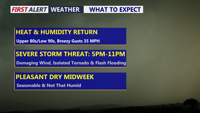
Delmarva faces a hot, humid and windy day with a risk for severe thunderstorms late this afternoon into tonight. Damaging winds, heavy rainfall, flash flooding and an isolated tornado are possible, with the greatest concern between roughly 5 p.m. and 11 p.m. A high rip current risk is also in place from Ocean City to Chincoteague.
From
To

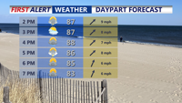
Warm, sticky air will dominate Delaware’s beaches and Ocean City, Md., midweek, with scattered storms Wednesday into Thursday before slightly drier conditions arrive.

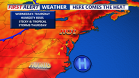
Sussex County’s beaches through Ocean City, Md., will see warm and muggy conditions into Thursday, with scattered storms possible as a cold front moves through.

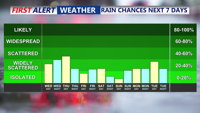
A stormy Sunday with widespread showers and thunderstorms, heavy rain potential, and an isolated severe storm threat. Humidity and heat will make it feel near 100 degrees before storms arrive. A clearing trend returns Monday and Tuesday, but heat builds again before a stronger cold front cools things down for next weekend.

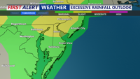
Delmarva faces an unsettled Sunday with showers and thunderstorms, some potentially severe with damaging winds and localized flash flooding. A warm front moves through ahead of a weak cold front Sunday night, followed by a hot and humid start to the week before a stronger midweek cold front brings relief heading into next weekend.

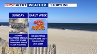
A warm front lifting into Delmarva Saturday night will bring clouds, muggy conditions, and a chance for storms, some of which could be strong with gusty winds. Sunday will feature periods of showers and thunderstorms before skies clear Monday, leading into a hot and humid start to the week. A midweek cold front promises relief by Friday and next weekend.

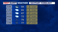
A warm and humid air mass will dominate from Thursday morning through early Saturday, bringing repeated rounds of showers and a chance for thunderstorms across Sussex County and Ocean City.