


DELMARVA - The early April weather rollercoaster continues, with a stretch of unsettled conditions expected across Sussex County, the Delaware Beaches, and Ocean City from Thursday morning through Saturday morning. Expect spring-like warmth and humidity to fuel multiple rounds of rain and thunderstorms as a frontal boundary lingers near the area.
Thursday Morning:
The day kicks off with cloudy skies, patchy showers, and lingering downpours from a decaying system that moved through overnight. While the morning hours may offer a brief lull in activity, don’t let your guard down. The warm front that pushed north overnight leaves the region in a muggy, unstable air mass, setting the stage for more showers and storms later.
Thursday Afternoon and Evening:
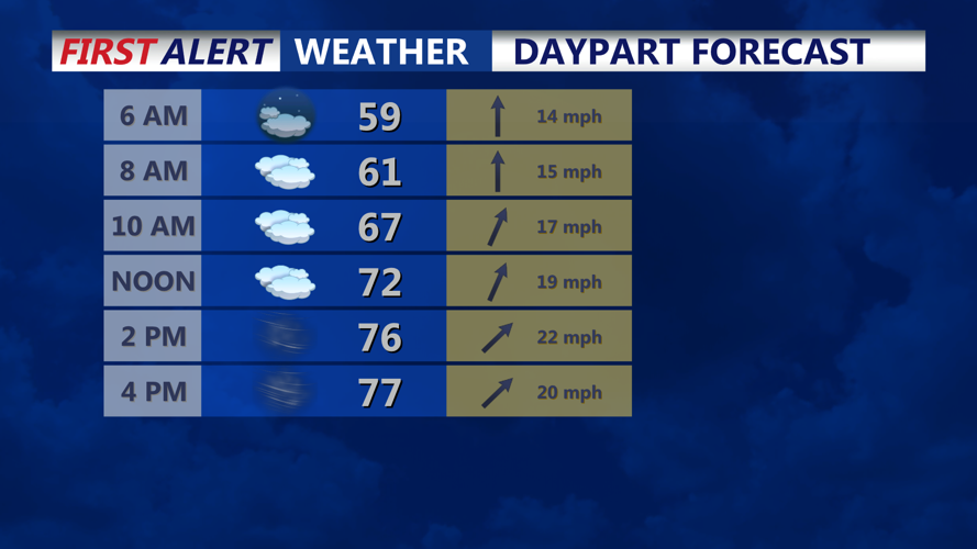
Temperatures will climb quickly despite overcast skies, reaching the upper 60s to upper 70s, with some inland spots possibly touching 80 degrees. Dew points in the low to mid 60s will make it feel almost summerlike. Scattered showers and thunderstorms will become more likely by mid to late afternoon as a cold front approaches from the west.
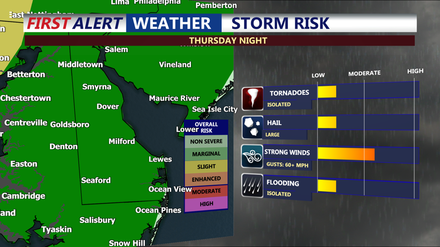
Some of these storms may turn strong to borderline severe, especially south of the I-78 corridor, where moisture levels are highest. The Storm Prediction Center has placed the region under a Marginal Risk (Level 1/5) for severe weather. Gusty winds are the main threat, though an isolated tornado cannot be ruled out given elevated wind shear.
Thursday Night Into Friday Morning:
The cold front will cross the region overnight, accompanied by widespread rain and embedded thunderstorms. With plenty of moisture in place—dew points holding in the 60s—locally heavy rainfall is likely. Though the risk of severe weather diminishes after sunset, expect occasional thunder and gusty downpours into early Friday morning.
Friday:
Rain exits by midday, and drier air begins filtering in from the northwest. Temperatures will drop a bit, with highs in the low to mid 60s, but the Delmarva region may stay milder—closer to 70 degrees—as it remains south of the frontal boundary. Dew points will also fall into the 40s and 50s, making for a much less humid afternoon.
Friday Night Into Saturday Morning:
Don’t put the umbrella away just yet. A new area of low pressure will pass north of the region, pulling the stalled front back north as a warm front. Another round of showers develops late Friday night and continues into early Saturday. Onshore flow will keep conditions cloudy and damp. Overnight lows will remain mild, mostly in the 50s.
By Saturday morning, the region remains under the influence of unsettled weather, with more rain possible later in the day as another disturbance approaches from the west.
