





Delmarva faces a hot, humid and windy day with a risk for severe thunderstorms late this afternoon into tonight. Damaging winds, heavy rainfall, flash flooding and an isolated tornado are possible, with the greatest concern between roughly 5 p.m. and 11 p.m. A high rip current risk is also in place from Ocean City to Chincoteague.
From
To


Delmarva will see a dry and gradually warming forecast beginning today, with inland temperatures in the 70s and cooler conditions along the coast. A high risk for dangerous rip currents continues from Delaware beaches south to Ocean City and Chincoteague. High pressure keeps the region dry through the end of the week, with some locations potentially reaching the low 90s by Friday and Saturday.


Delmarva stays sunny, dry, and breezy today with highs in the low 70s inland and upper 60s along the coast. A high risk of rip currents remains in place, with northeast winds gusting up to 25 mph and waves of 3 to 5 feet.


Delmarva will see a mild but unsettled Memorial Day with showers and a brief downpour or gusty thunderstorm possible late this afternoon into the evening. Highs will reach the mid 70s with southwest winds near 20 mph. Rainfall could total 1 to 2 inches in spots, and a high rip current risk continues along the beaches. More scattered showers remain possible Tuesday and Wednesday before drier weather returns late this week.


Delmarva will begin the holiday weekend with raw, breezy, and damp conditions today as spotty showers move across the peninsula. Temperatures will stay in the upper 50s to low 60s with east winds gusting up to 30 mph. A high rip current risk and cold ocean water will make beach and surf conditions dangerous today and tomorrow. Rain becomes steadier Saturday into Saturday night, with beneficial rainfall expected before showers taper Sunday. Memorial Day looks somewhat warmer, but showers may still linger at times.


Delmarva’s record-breaking heatwave is over as a cold front stalls nearby, bringing cloudy, breezy and unsettled weather through Memorial Day. Periods of rain, cooler temperatures and elevated rip current risks are expected, though the rainfall will be beneficial amid ongoing severe drought conditions.

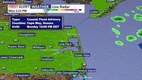
Hurricane Erin will stay well offshore this week, but its effects will still be felt along Sussex County beaches down to Ocean City, with dangerous surf, coastal flooding, and unsettled weather before calmer conditions return late week.