


DELMARVA -- Today marks the end of the record-breaking heatwave across Delmarva as a cold front pushes through the region and eventually stalls nearby. That front will help set up a cooler, unsettled pattern that lasts through the holiday weekend.

Showers develop this evening through the overnight, winds will gust out of the northeast to 30 mph.
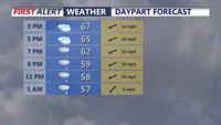
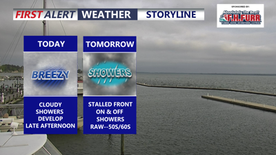
Clouds will dominate today as a northeast flow develops, with wind gusts near 30 mph at times. Temperatures will settle into the upper 60s to low 70s, a noticeable change from the recent heat. Scattered showers are expected to develop into the evening.

A stalled out front will bring unsettled weather through the holiday weekend.
Beach conditions will also become rougher. A moderate rip current risk is in place today, with a high rip current risk expected Friday. Waves will run between 2 and 4 feet.
Tonight, showers continue with temperatures dropping into the low to mid 50s.
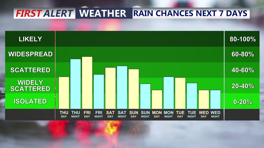
Friday will bring cool, raw and generally unpleasant conditions across Delmarva. Periods of rain are expected, with a possible lull during the afternoon before another round of rain arrives late Friday and continues into Saturday.
Saturday will bring more of the same, with on-and-off rain, persistent east winds and temperatures mainly in the 50s and 60s. While it will not be an ideal start to the holiday weekend, the rain will be beneficial as severe drought conditions continue across the region.
Some drier conditions may begin to work in by Sunday afternoon, with temperatures bouncing back into the 70s. Memorial Day looks mostly cloudy with only an isolated shower chance and highs in the mid to upper 70s.

As severe drought continues, beneficial rainfall from tonight-Memorial Day, not the best timing.
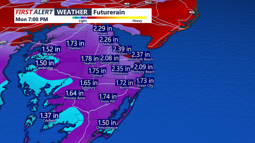
Rainfall totals from tonight through Memorial Day are expected to range from 1 to 2 inches across Delmarva, with locally higher amounts possible. While the holiday weekend forecast is far from perfect, the incoming rain will provide much-needed relief for the dry conditions.
