




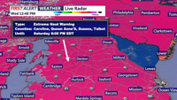
Dangerous heat arrives Thursday, with heat index values climbing into the 105- to 110-degree range.
From
To


Temperatures possibly hotter than 90 degrees are expected as the Independence Day holiday weekend approaches. The conditions are prompting people across the area to take precautions while spending time outdoors.

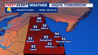
A hotter and more humid pattern begins Wednesday as Sussex County and Ocean City prepare for several days of potentially dangerous heat.

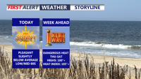
Delmarva will enjoy a sunny, comfortable start to the week before dangerous, potentially record-challenging heat builds by midweek and lasts into the Fourth of July weekend.

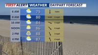
A stalled front over Delmarva Sunday will trigger heat and isolated storms to start the week. By Tuesday, a stronger cold front will bring the chance of severe thunderstorms. High pressure then builds in midweek, setting up lower humidity and comfortable weather heading into the Fourth of July holiday weekend.

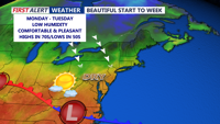
A bright and breezy start to the week as high pressure takes hold the next couple of days. However, the rain returns Wednesday along with chilly temperatures.


Delmarva residents can expect a wet and gusty start to Thanksgiving as a low-pressure system brings rain to the region. Conditions will improve by Thanksgiving afternoon into the evening, with dry but breezy weather. A colder, drier air mass will dominate through the weekend, keeping temperatures below normal into early next week.