


DELMARVA - A dangerous stretch of heat and humidity will build into Sussex County late Wednesday evening and continue through Thursday evening, setting the stage for what could become one of the hottest periods of the summer.
A few thunderstorms may linger into Wednesday evening, and any storm that develops could produce damaging wind gusts. The threat will be isolated, but storms may briefly become strong as hot and humid air remains in place.
Conditions will stay very warm and muggy overnight, with temperatures only falling into the upper 70s to near 80 degrees in many areas. That will offer little relief before the worst of the heat arrives Thursday.
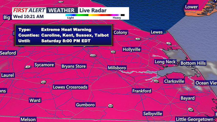
An Extreme Heat Warning takes effect at noon Thursday and continues through at least 8 p.m. Saturday for Sussex County and much of Delmarva. High temperatures Thursday are expected to climb into the upper 90s to near 100 degrees, with some inland communities potentially reaching the century mark. Heat index values will make it feel closer to 105 to 110 degrees during the afternoon and early evening.
The hottest conditions are expected Friday, but Thursday will mark the start of a dangerous and prolonged heat wave. The combination of intense heat, humidity and warm overnight temperatures will increase the risk for heat-related illness, especially for those working outdoors, older adults, young children and anyone without reliable air conditioning.
Beach communities may run slightly cooler than inland areas, but the Delaware beaches will still be hot and humid, with heat index values reaching dangerous levels. Anyone heading outdoors should take frequent breaks, drink plenty of water and avoid strenuous activity during the hottest part of the day.
The heat will continue into the holiday weekend. Additional afternoon and evening thunderstorms may become more widespread starting Friday and lasting into Saturday and Sunday, potentially affecting outdoor holiday plans across Sussex County.
