


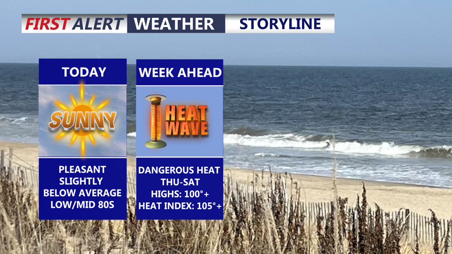


DELMARVA -- The week is starting on a beautiful note across Delmarva, but a dangerous stretch of heat and humidity is on the way.

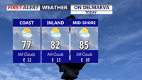
Becoming sunny, east wind will keep the coast in the upper 70s, warmest temperatures along the Mid-Shore.
Today will bring sunny skies and comfortable conditions for late June, with highs in the low to mid-80s inland and upper 70s along the coast. East winds at 10 to 15 mph will help keep the beaches cooler. Tonight will be partly cloudy and mild, with lows falling into the low 60s.
A strengthening ridge of high pressure will begin to take over Tuesday, starting a warming trend across the peninsula. Skies will be partly cloudy, with highs climbing into the upper 80s to near 90.

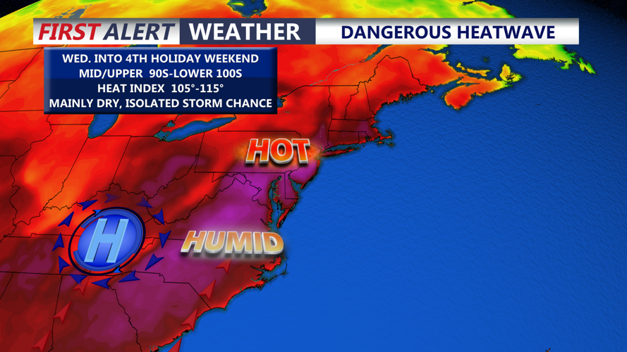
A prolonged stretch of dangerous heat and humidity develops Wednesday-Saturday.
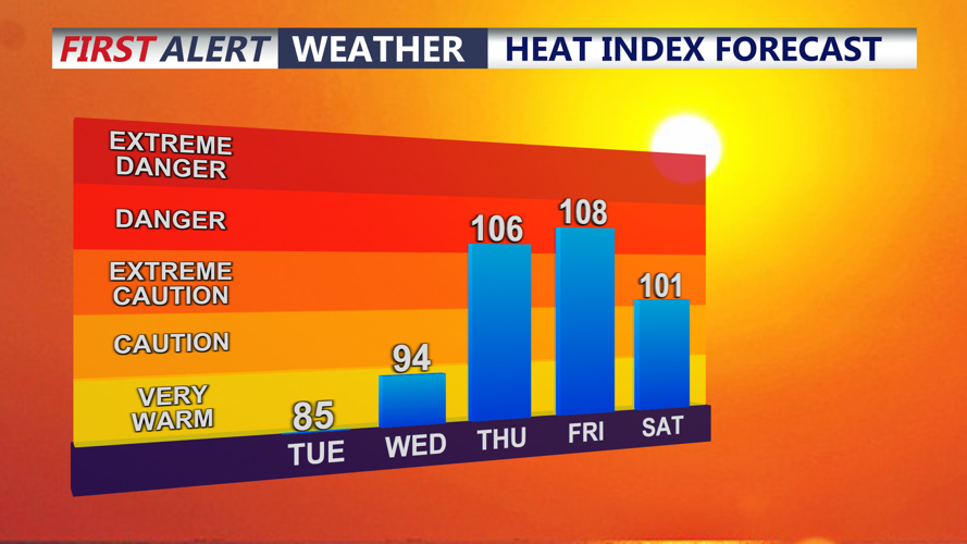
The heat becomes much more dangerous by Wednesday, when highs are expected to reach the mid- to upper 90s. With higher humidity still in place, heat index values could climb to around 100 to 105 degrees.
Thursday and Friday are expected to be the hottest days of the week, with inland temperatures surging to 100 to 105 degrees. Heat index values may reach 105 to 110+ degrees, creating a dangerous situation for anyone spending time outdoors. The pattern could challenge daily records and possibly all-time temperature records in parts of the region.

Heat Indices Thursday-Saturday: 103°-110°
In Georgetown, the record high for Thursday is 99 degrees, set in 1953. Friday’s record is 101, set in 1954, while Saturday’s record is 100, set in 1966. Georgetown’s all-time hottest temperature is 104 degrees, set in June 2011. The area also has never recorded three consecutive days at or above 100 degrees, a mark that could be challenged this week. Last year, Georgetown recorded two consecutive 100-degree days on June 24 and 25.
The Fourth of July on Saturday will still be very hot, even as the ridge begins to weaken. Highs are expected to remain in the mid-90s to near 100, with heat index values generally around 100 to 105 degrees and locally near 110 where humidity does not mix out. Sunday and Monday should bring some improvement, but highs may still reach the low to mid-90s with heat index values in the mid-90s to low 100s.
The extreme heat may also be joined by storm chances heading into the holiday weekend. Afternoon and evening thunderstorms will be possible starting Friday, with better chances Saturday and Sunday as the ridge begins to break down. Any storms that develop could become strong to severe, which could affect Fourth of July weekend events across Delmarva.
Residents and visitors should plan for several days of dangerous heat. Limit outdoor activity during the hottest part of the day, drink plenty of water, check on vulnerable neighbors and pets, and never leave children or animals in vehicles.
