


DELMARVA - A quiet but muggy Tuesday night will give way to a hotter Wednesday across Sussex County, Delaware, and south into Ocean City, Maryland, as dangerous heat begins building across the Mid-Atlantic.
Most of the thunderstorm activity Tuesday evening is expected to stay farther north, but an isolated storm cannot be ruled out overnight. Any storm that does develop could produce gusty winds, frequent lightning and brief heavy rain.
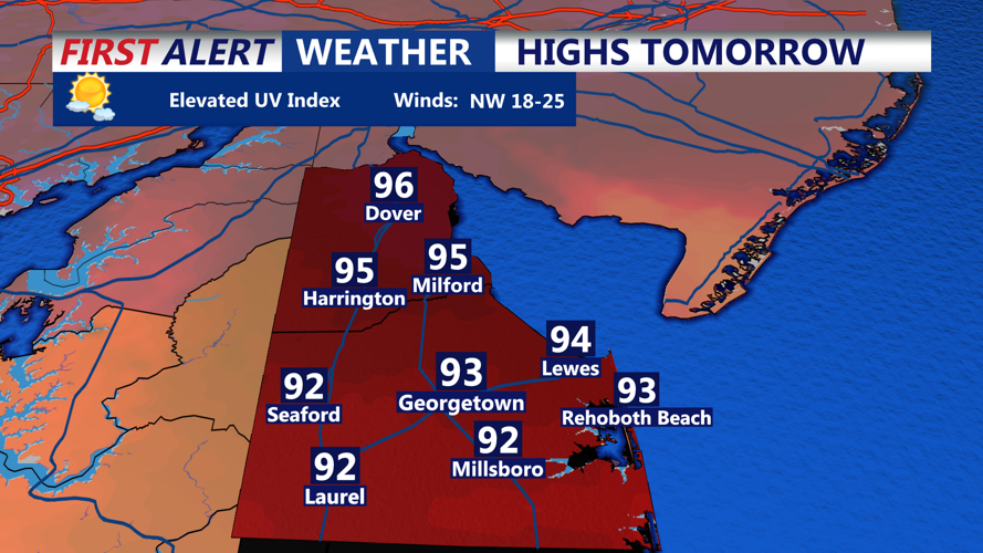
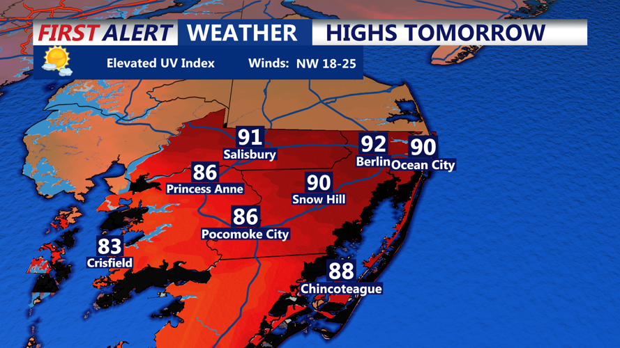
Wednesday will mark the beginning of a significant heat wave for the region. Highs are expected to climb into the mid to upper 90s inland, with heat index values near 100 to 105 degrees. Conditions will be slightly cooler along the immediate beaches, but humidity will still make it feel uncomfortable through the afternoon and early evening.
A few isolated thunderstorms are possible Wednesday afternoon or evening. While storms are not expected to be widespread, any storm that forms in the hot and unstable atmosphere could produce strong wind gusts or a brief damaging microburst.
The more dangerous heat arrives Thursday and Friday, when temperatures may climb near or above 100 degrees across parts of Delmarva. Heat index values could reach the 105 to 110 degree range, and all-time record high temperatures may be challenged in the region.
An Extreme Heat Watch remains in effect for Delmarva from Thursday afternoon through Saturday. The prolonged stretch of heat could increase the risk of heat-related illness, especially for people spending time outdoors during the busy holiday week.
Thunderstorm chances may also become more widespread by Friday and continue at times through the holiday weekend, bringing the potential for afternoon and evening disruptions in addition to the extreme heat.
