Delmarva saw a week of major headlines, including criminal charges against a Lewes fire police officer, plans to repair the Indian River Inlet north jetty, record-breaking heat and lingering wildfire smoke that prompted health advisories.
Delmarva saw a week of major headlines, including criminal charges against a Lewes fire police officer, plans to repair the Indian River Inlet north jetty, record-breaking heat and lingering wildfire smoke that prompted health advisories.
A warmer Tuesday will set the stage for dangerous heat later this week across Sussex County.
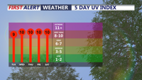
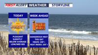
Delmarva will enjoy a sunny, comfortable start to the week before dangerous, potentially record-challenging heat builds by midweek and lasts into the Fourth of July weekend.
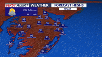
Dangerous heat and humidity will grip Delmarva today and Friday, with heat index values climbing as high as 95 to 105 degrees and record highs possibly being challenged in Georgetown. Scattered strong to severe thunderstorms are also possible both afternoons and evenings, with damaging winds the main concern. A cold front late Friday will bring less humid air for the weekend, followed by another chance of showers and storms Sunday night and more seasonable weather next week.
Hot, more humid weather will continue across Sussex County through Tuesday night, with inland areas facing near-record heat and peak heat index values close to 100 degrees.
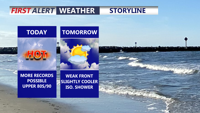
Today marks the third straight day of record-setting heat potential across Delmarva, with highs reaching the upper 80s to around 90 under partly cloudy skies. Dry air, gusty southwest winds, and ongoing drought conditions will also create an elevated fire weather risk. A weak front brings only slight cooling Friday, while a sharper cooldown arrives over the weekend with much-needed rain late Saturday night into Sunday. Early next week turns significantly cooler, with frost or even freeze conditions possible by Monday night into Tuesday morning before temperatures rebound by midweek.
This afternoon, we'll see a mix of sun and clouds, with breezy and cool conditions. Northwest winds will gust 25 to 35 mph at times.
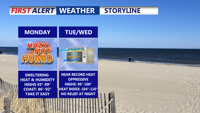
A strong high-pressure system building over the Mid-Atlantic will bring dangerously hot and humid conditions to Delmarva starting Monday. Heat index values are forecast to soar between 100 to 110 degrees through Tuesday, with only slight relief expected by midweek. Heat Advisories remain in effect, with an Extreme Heat Watch issued for parts of southern Delmarva. Rain chances and cooler temperatures return by late week.
Tuesday's dry conditions will give way to increasing temperatures and humidity across Delmarva, with a Heat Advisory in place due to expected excessive heat impacts.