


DELMARVA -- A stretch of dangerous heat and humidity today through Friday, with potentially record-challenging temperatures and a continued risk for strong to severe thunderstorms.
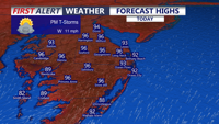
A mid-level ridge moving across the Mid-Atlantic and Northeast, combined with high pressure offshore of the Southeast coast, will keep a hot and humid air mass in place across Delmarva. High temperatures today and Friday are expected to climb into the low to mid 90s for most communities, with Friday potentially running a little hotter than today.
In Georgetown, the record high for today is 95 degrees, set in 1947 and tied in 1959. Friday’s record high is also 95 degrees, set in 2017. Those records could be challenged during this stretch of heat.
Dewpoints will begin in the low to mid 70s, making the air feel very humid. Afternoon mixing may lower dewpoints somewhat into the upper 60s and low 70s, but heat index values are still expected to peak between 95 and 105 degrees across much of Delmarva. This level of heat can become dangerous quickly, especially for sensitive individuals, those without reliable cooling, and anyone spending long periods of time outdoors.

Feeling like 100 to 105 degrees on Delmarva this afternoon.
A westerly wind should be strong enough to keep the sea breeze just offshore for much of the day, though it may try to push onshore later. If that happens, areas right along the Atlantic beaches could see some quicker cooling during the late afternoon or evening.
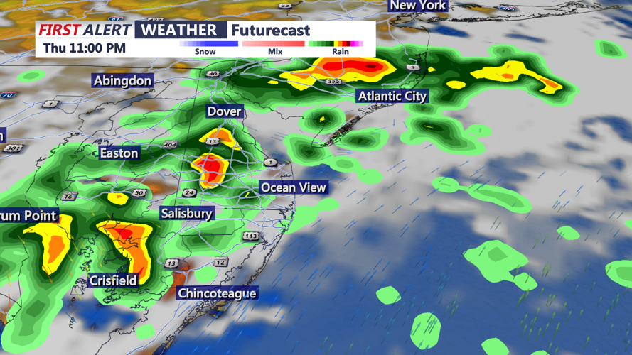
In addition to the heat, Delmarva will also need to watch for thunderstorms today and Friday. A few showers and storms may develop during the late afternoon and evening hours today, mainly between about 5 p.m. and 11 p.m. from west to east. A disturbance tied to leftover upstream storms from the Midwest may help storms redevelop and organize as they move toward the area.

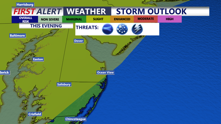
Slight risk (2 of 5) for severe storms between 7PM-11PM, damaging winds and large hail are the primary threats.
Delmarva remains under a Slight Risk, level 2 out of 5, for severe thunderstorms today. Damaging wind gusts are the main threat, especially if storms cluster or form into broken lines. Large hail cannot be ruled out because of the amount of instability expected.

Watching the threat for a few strong to severe storms between 7PM-12AM, damaging winds and hail are the main threats.
Friday brings another round of heat and humidity, along with another severe thunderstorm risk. A cold front approaching from the west, along with stronger upper-level support, should help focus showers and thunderstorms near and ahead of the boundary. The entire area is again highlighted in a Slight Risk, level 2 out of 5, for severe thunderstorms. Damaging winds will once again be the primary concern.
The cold front is expected to move through Delmarva late Friday, bringing some relief for the weekend. Temperatures will still be warm to hot, with highs generally in the upper 80s to mid 90s, but humidity levels will drop noticeably. Dewpoints may fall into the 50s in some areas Saturday, making conditions feel much more comfortable compared to today and Friday.
Another cold front is expected to move through late Sunday night, bringing a renewed chance for scattered showers and thunderstorms. This setup does not appear as favorable for severe weather because the front will arrive overnight, limiting instability. However, there should be enough moisture and forcing to support some needed rainfall.
Behind that front, a more seasonable air mass is expected to settle into Delmarva for Monday through Wednesday. Highs should range from the upper 70s to mid 80s, with overnight lows in the mid 50s to low 60s. Dewpoints in the 50s and low 60s will make for much more pleasant conditions through the middle of next week, with only a low chance for a stray shower.
