


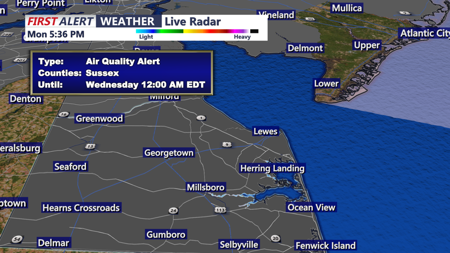


DELMARVA - Hot and increasingly humid conditions will continue across Sussex County late Monday night through late Tuesday evening, as an early season heat wave keeps temperatures well above normal for mid-May.
Strong ridge of high pressure off the Southeast coast and surface high pressure over the western Atlantic will keep a south to southwest flow over the region. That pattern will allow unusually warm air to remain in place through Tuesday.
Monday night will stay warm by mid-May standards, with lows only falling into the mid-60s to lower 70s. Those readings could challenge daily records for the warmest low temperatures for May 19.
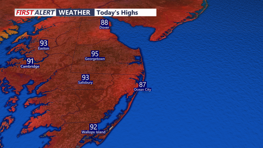
Tuesday is expected to bring another day of significant heat, especially away from the beaches. Inland portions of Sussex County are forecast to climb into the 90s, with heat index values generally in the mid-90s and possibly nearing 100 degrees. Immediate coastal communities should be cooler, as a more southerly or southeasterly wind brings marine air inland from the chilly ocean waters.
The heat may have a greater impact because many residents have not yet acclimated to summerlike conditions. People spending time outdoors Tuesday should take frequent breaks, drink plenty of water and avoid strenuous activity during the hottest part of the day.
The forecast remains mainly dry through late Tuesday evening. A cold front is expected to approach Wednesday, bringing a chance of showers and thunderstorms before much cooler air arrives later in the week.
