




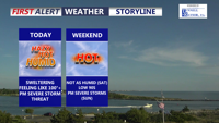
Delmarva will face another day of near-record heat, high humidity, and a slight risk for severe thunderstorms today. A cold front moving through tonight will bring a more comfortable weekend, though another round of showers and storms could return late Sunday into Sunday night.
From
To

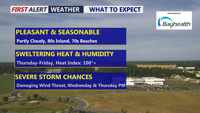
Delmarva will enjoy a beautiful and seasonable day today, with highs in the low 80s inland and low 70s along the coast. Humidity begins to return tonight, setting the stage for scattered showers and storms Wednesday and Thursday. Dangerous heat is likely late this week, especially Thursday and Friday, before a cold front brings some relief into the weekend.


Delmarva will see some improvement today after morning showers and drizzle, but clouds and muggy conditions will continue as a stationary front lingers nearby. More showers are expected tonight into Wednesday, with a brief gusty thunderstorm possible late Wednesday before drier, more seasonable weather returns for the end of the week and weekend.

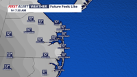
Sussex County, Delaware, and Ocean City, Maryland, will experience gusty winds and below-normal temperatures late Thursday into Friday, with calmer conditions and a gradual warming trend through the weekend.

Delmarva will experience a breezy Sunday evening followed by calmer conditions overnight. By Monday morning and afternoon, temperatures will warm slightly ahead of a weak warm front, with dry and seasonable weather dominating.

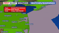
Chilly and increasingly cloudy today, followed by widespread minor coastal flooding starting with Thursday morning's high tide. A Coastal Flood Advisory remains in effect through Friday due to elevated astronomical tides from the full moon and persistent onshore winds. Rain is expected this evening into Friday morning, with up to a half an inch possible. By the weekend, drier air and milder temperatures in the 60s will settle in, but breezy conditions could persist.

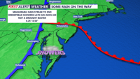
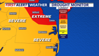
This weekend brings a noticeable cool down to Delmarva. High pressure builds in on Saturday, ensuring sunny skies but cooler temperatures struggling to get to 60. By Sunday, a warm front approaches, increasing clouds and bringing much-needed rain by late Sunday into Monday morning. Rainfall totals of 0.25-0.50 inches are expected, offering some relief to ongoing drought conditions. The week ahead looks dry and seasonable through midweek, with potential for a coastal low bringing more rain late next week.

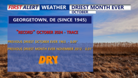
October brought record-breaking dry conditions to Delmarva, with Georgetown marking 35 consecutive days without measurable rainfall. High pressure will dominate through early next week, maintaining clear skies and cool nights, but temperatures are expected to warm into the 70s by Tuesday. A weak cold front arrives midweek, offering a slight chance of rain, before high pressure returns to end the week.