





DELMARVA -- One more beautiful and seasonable day today before a more humid and unsettled pattern takes over.

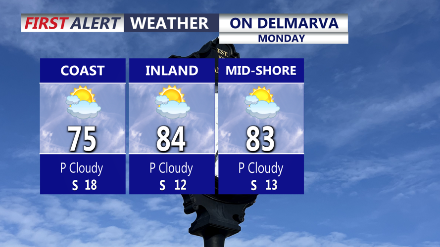
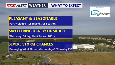
Highs in the low 80s inland to the Mid-Shore, low to mid 70s at the coast.
Highs today will climb into the low 80s for much of the peninsula, while coastal communities stay cooler in the low 70s. It will be a great day to spend time outside, especially before humidity starts knocking on the door later tonight.
Clouds will increase tonight as high pressure slides offshore and warmer air begins moving into the region. Overnight lows will be much milder than this morning, mainly in the mid 50s to mid 60s. Temperatures may even slowly rise toward daybreak Wednesday as a warm front lifts north.
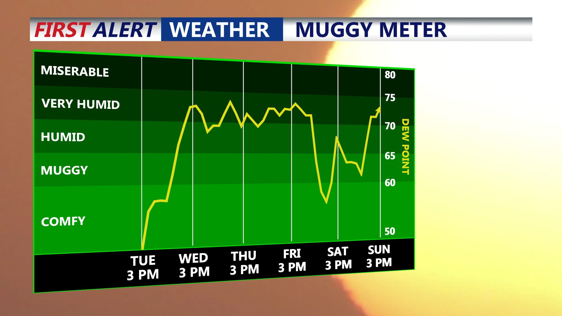
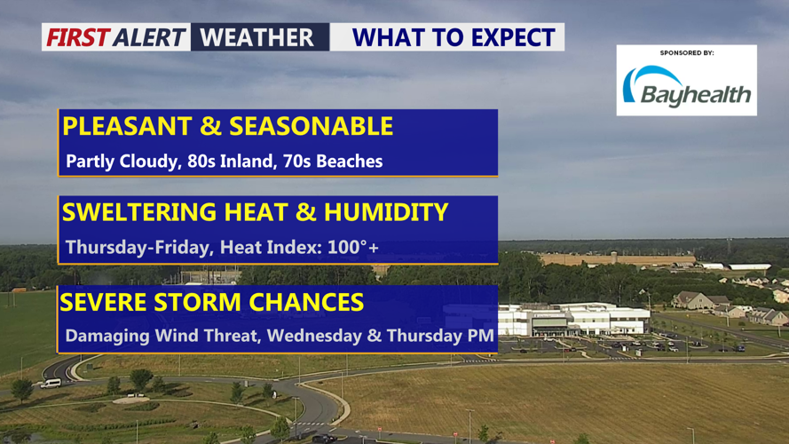
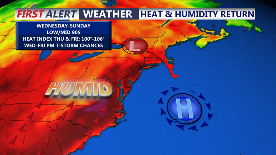
Tropical-like feel on Delmarva beginning Wednesday-Friday.
By Wednesday, Delmarva will see a better chance for scattered showers and thunderstorms as a weak disturbance and surface trough move through the area. Rain chances are around 40% to 60%, but not everyone will see rain due to the scattered nature of the storms.
The Storm Prediction Center has placed a "Marginal" risk, 1 out of 5 for an isolated severe storm for Wednesday & Thursday late afternoon into the evening. Damaging winds is the primary threat and large hail. Again everyone will not see a storm.
Thursday will remain humid and unsettled, though the trigger for storms looks less defined. Isolated to scattered showers and storms will still be possible, with rain chances generally between 30% and 60%.

Heat indices Thursday -Friday will feel like over 100 degrees.
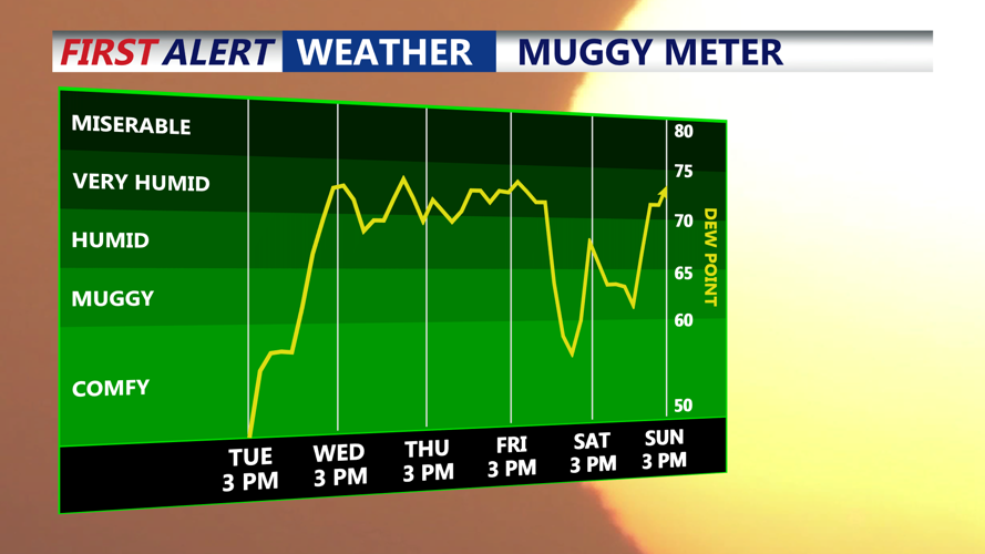
The bigger story late this week will be the heat. Thursday and Friday currently look like the hottest days across Delmarva, with inland highs climbing into the low to mid 90s. With dew points in the low 70s, heat index values may reach the upper 90s to low 100s. This level of heat and humidity can become dangerous quickly, especially for sensitive individuals and anyone spending long periods outdoors.
By late Friday into Saturday, a cold front will approach Delmarva. Scattered showers and thunderstorms may develop near and ahead of the front, and some stronger storms could be possible depending on how much instability builds and how wind fields evolve. This setup will need to be watched over the next few days.
Behind the front, the first part of the weekend is trending drier. Temperatures and humidity should ease somewhat, offering at least some relief from the late-week heat. Temperatures will hover around the low 90s under mainly dry conditions Saturday and Sunday. However, another front may approach by late weekend into early next week, keeping the overall pattern somewhat unsettled for Delmarva.
