




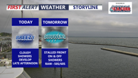
Delmarva’s record-breaking heatwave is over as a cold front stalls nearby, bringing cloudy, breezy and unsettled weather through Memorial Day. Periods of rain, cooler temperatures and elevated rip current risks are expected, though the rainfall will be beneficial amid ongoing severe drought conditions.
From
To


Sussex County will wake up cooler Thursday with clouds, northeast winds and scattered showers that may linger into early Friday.

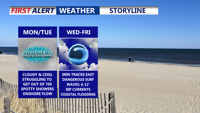
A stalled cold front south of Delmarva will bring sharply cooler, breezy conditions Monday, with highs only in the 70s under mostly cloudy skies with some showers possible. High pressure from the north will reinforce the cool pattern through midweek, while Hurricane Erin remains offshore but creates coastal hazards including high surf, rip currents, and possible flooding.

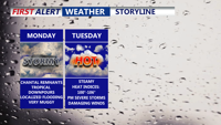
Starting Monday, Delmarva will enter a prolonged stretch of hot, humid, and stormy weather. The remnants of Tropical Storm Chantal will bring widespread showers and thunderstorms capable of downpours and localized flooding. Even the threat for severe storms Tuesday. As the week progresses, a stalled front and several disturbances will prolong unsettled conditions, with dangerous heat indices nearing 106 degrees and repeated rounds of storms expected into the weekend

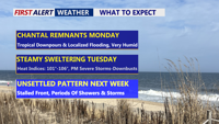
Beginning Sunday night, Delmarva will enter a period of high humidity and unsettled weather. The remnants of Tropical Storm Chantal will bring rounds of showers and thunderstorms Monday and Tuesday, with locally heavy rainfall and potential flash flooding. Severe storms possible Tuesday afternoon/evening. A stalled cold front will keep the region stormy through late week, while oppressive heat and humidity push heat index values to near 106 degrees.

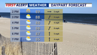
A stalled front across Delmarva Sunday afternoon will keep heat and isolated storms in the forecast to start the week. By Tuesday, a stronger cold front brings the potential for severe thunderstorms. After midweek, high pressure settles in, leading to more comfortable conditions and pleasant weather just in time for the Fourth of July holiday weekend.

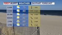
A stalled front over Delmarva Sunday will trigger heat and isolated storms to start the week. By Tuesday, a stronger cold front will bring the chance of severe thunderstorms. High pressure then builds in midweek, setting up lower humidity and comfortable weather heading into the Fourth of July holiday weekend.