


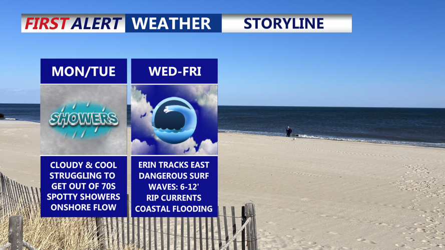

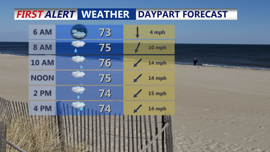


DELMARVA -- We begin the workweek with a sharp change in weather as cooler air settles in behind a cold front stalled over southern Virginia. Monday will be a noticeable shift from Sunday’s warmth, with northeast winds ushering in cooler temperatures and lower humidity. Highs will hold in the 70s, with a few 80s under mostly cloudy skies, and winds may gust between 20 and 30 mph before easing later in the day. Scattered showers are possible, Monday afternoon-evening.

Temperatures will be in the 70s with a lot of low clouds and scattered showers developing in the afternoon-evening.
By Monday night, a high-pressure system moving in from the north will reinforce the cooler pattern. Overnight lows will dip into the low to mid-60s, with daytime highs Tuesday also staying in the low to mid-70s. The onshore flow will persist, keeping skies generally cloudy and conditions unseasonably cool.
The stalled boundary to the south could bring another round of isolated showers Tuesday into Wednesday, and shortwave energy arriving from the west may trigger scattered showers or a few thunderstorms midweek. Temperatures will remain below seasonal averages.

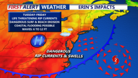
Erin will be hundreds of miles offshore, but will produce dangerous life threatening surf and rip currents. Along with coastal flooding and beach erosion.
Farther offshore, Hurricane Erin will not make a direct strike on Delmarva, but its impacts will still be felt. Prolonged onshore flow and long-period swells are expected to create high surf and dangerous rip currents along area beaches. Coastal flooding and beach erosion are possible as well. Wave heights will likely peak Thursday reaching 8 to 12 feet.

Wave heights will be increasing with each day this week, peaking Thursday with waves as high as 10 to 12 feet.
Looking ahead, high pressure should bring calmer and drier weather toward the end of the week with seasonable conditions returning. Another round of unsettled weather could approach by Sunday.