




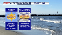
Delmarva started the day with a cold morning, with many spots away from the coast in the 20s, but sunshine and lighter winds will help temperatures recover into the mid to upper 50s and near 60 this afternoon. Milder air builds in tonight and Wednesday, with highs surging into the upper 60s and low 70s. Even warmer weather arrives Thursday and Friday before a cooler pattern and the chance for beneficial widespread rain return this weekend.
From
To


Today marks a sharp change across Delmarva as a cold front pushes through, sending temperatures tumbling from the 70s into the 50s and 40s with gusty north to northeast winds. Rain arrives late this afternoon and continues through the evening, creating a damp and raw end to the day before ending before midnight. The weekend turns sunny but chilly, with blustery conditions Saturday and a milder Sunday.

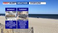
Delmarva will experience warm, humid conditions with a daily risk of showers and storms. Fog and mist are likely to start the day, especially along the coast. A cold front arriving late Monday will trigger scattered thunderstorms and downpours into the evening. This front is expected to stall through midweek, sustaining unsettled weather with periods of heavy rain, though the severe threat remains low. Can't rule out the possibility of flash flooding. By late week, heat and humidity will intensify, pushing heat index values toward 100 degrees before another cold front approaches.


Delmarva will experience humid, foggy nights and a stretch of unsettled weather through midweek. Beginning Sunday night, areas of mist and patchy fog will develop, especially along the coast. A cold front approaching late Monday will trigger showers and thunderstorms, with the primary concern being heavy rain and flash flooding. While the severe thunderstorm risk is low, locally gusty winds cannot be ruled out. The front is expected to stall through Wednesday, keeping rain chances high before heat and humidity surge again later in the week.

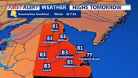
Inland Sussex County will experience warm, breezy conditions late Tuesday into Wednesday, while coastal areas will see cooler, cloudier weather as a cold front approaches.

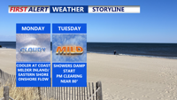
Delmarva starts the week under the influence of high pressure with mild temperatures and filtered sunshine on Monday. A weak cold front brings a chance of showers late Monday night into early Tuesday. A warm-up follows, with sunshine midweek and highs in the 70s. Another system may bring rain and cooler conditions by the weekend.

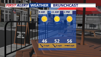
After a breezy and mild Tuesday morning, clouds thicken along Delaware’s coast with light rain possible overnight and early Wednesday, before gradual clearing by midday.

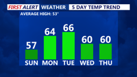
Delmarva will experience clear and chilly conditions Sunday night, with lows in the mid-30s. A warming trend kicks off Monday, with highs reaching the low to mid-60s under mostly sunny skies. A stronger low will move in Monday night into Tuesday, lifting a warm front northward. By Tuesday, temperatures will climb further into the 60s, though a backdoor cold front could bring midweek uncertainty. A high-pressure system will briefly cool things down Wednesday before warmer air returns later in the week. By Saturday, highs could push into the upper 60s to low 70s.


Delmarva will see sunny but breezy conditions Sunday, with highs in the mid to upper 50s and gusts up to 30 mph, raising fire concerns. A warming trend begins Monday, with highs reaching the low to mid-60s under mostly sunny skies. Temperatures climb further Tuesday, but a backdoor cold front could limit Wednesday’s warmth. By Thursday, temperatures rebound into the 50s and 60s, with a continued warm stretch into the weekend. Highs could reach the upper 60s to low 70s by Saturday.

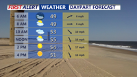
Sussex County will experience a range of weather conditions from Tuesday through Thursday, including mild temperatures, a cold front passage, and a mix of precipitation types.