


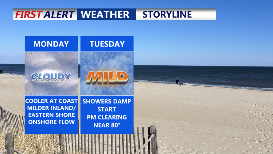

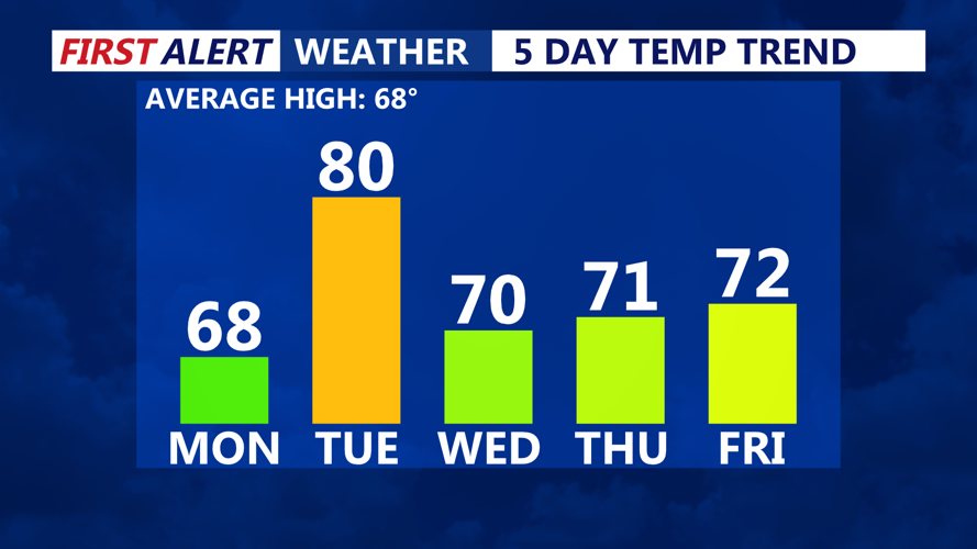


DELMARVA -- Monday begins with high pressure offshore and east to southeast winds influencing the region. As warmer air flows into the area, low clouds will drift across Delmarva in the morning, but breaks in the clouds are expected by afternoon. Skies should turn partly sunny, with high temperatures reaching the mid 60s across the peninsula.
A weak cold front approaches from the west late Monday night, bringing a chance of light showers—mainly overnight into early Tuesday morning. While rain amounts will be limited and most of the forcing remains to the north, a few passing showers are possible. Overnight lows will hover near 60 degrees in Delmarva.
By Tuesday, any lingering morning showers should quickly move out as the front sweeps the marine layer offshore. Behind the front, expect clearing skies and a significant temperature bump thanks to a gusty northwest wind. Most of Delmarva will climb into the low to mid 70s, with inland areas possibly nearing 80 degrees.
Tuesday night brings calmer winds and the potential for some mid and high-level clouds, especially to the north. Lows will dip into the 50s across the region.
Wednesday is shaping up to be one of the nicest days of the week. With high pressure regaining control, mostly sunny skies are forecast and slightly cooler air will settle in. Highs should range through the 70s inland, with coastal areas staying in the 60s due to the influence of cooler marine air. Wednesday night will be quiet and cool again, with lows in the 50s.
Looking into the long-term forecast, Thursday continues the dry trend with high pressure still dominant. A slight warming trend begins inland, where highs could reach the mid to upper 70s, while coastal locations remain more seasonable.
The next potential weather maker arrives Friday into Saturday as a low-pressure system and frontal boundary slowly push across the region. Forecast confidence remains low regarding the exact timing and severity of this system, but rain appears most likely from Friday night into Saturday. There is a slight chance of thunderstorms, although marine air could dampen instability. Temperatures will remain near 70 on Friday, rise slightly Saturday, and then drop into the 60s by Sunday as cooler and drier air settles in post-front.
