


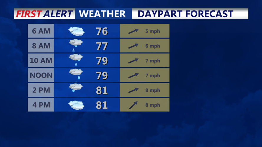


DELMARVA - Showers and thunderstorms will continue across Delmarva Thursday morning due to a fast-moving upper-level trough and its associated surface front. Precipitable water values (PWATs) remain high, ranging between 1.5 and 2.5 inches, which will keep the potential for localized heavy downpours in place.
Thursday Afternoon:
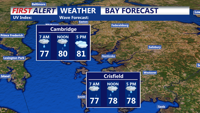
By the afternoon, the probability of precipitation (PoPs) will be between 45-55% for the northern half of the area and 55-65% for the southern half. The moist air will linger longer in the southern regions, maintaining a higher chance for showers and storms there. Despite the active weather, daytime temperatures will be near climate normals, with highs in the mid-80s.
Thursday Evening:
As the front continues its eastward progression, we can expect a reduction in the coverage and intensity of showers and storms by Thursday evening. The chance of precipitation will decrease significantly, with PoPs dropping to 30% or less across the region. Clearing skies will start to be more evident.
Early Friday Morning:
By early Friday morning, high pressure will begin to build in from the west, bringing clearer skies and cooler temperatures. Overnight lows will range from the mid to upper 60s, nearing 70 degrees. The reduced moisture and clear skies will allow for more efficient radiational cooling, making it a comfortable start to the day.