


DELMARVA - A mid-level disturbance sliding southeast of the Hudson Bay helped drive a powerful cold front across the region Sunday evening, marking the beginning of a sharp temperature plunge. The front passed through Sussex County mainly dry, though a few flurries were reported farther north. For Sussex County, the most noticeable impacts were falling temperatures and increasing winds overnight.
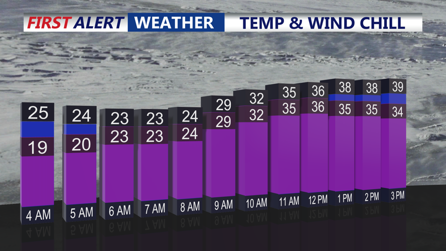
Behind the front, winds strengthened with gusts reaching twenty-five to thirty-five miles per hour at times through early Monday. Temperatures dropped into the mid and upper twenties by daybreak, setting the stage for a frigid start to the workweek.
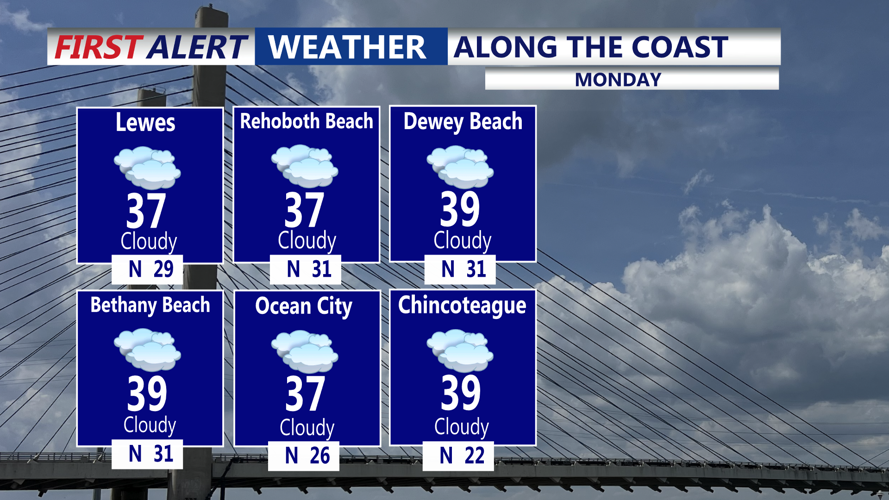
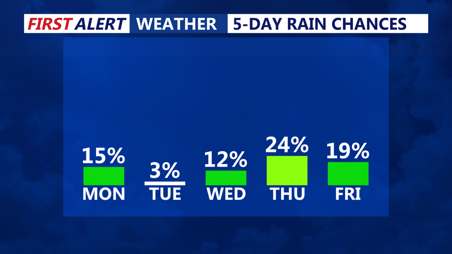
On Monday, strong high pressure building in from the Great Lakes kept conditions cold and dry across Sussex County. Highs only reached the mid-thirties along the coast and remained near freezing inland. Skies stayed partly to mostly cloudy as a weak coastal system developed well to the south. While light snow brushed parts of the lower Eastern Shore, precipitation stayed south of Sussex County, leaving the area dry through Monday evening.
The arctic air mass continued to deepen into Monday night, with skies gradually clearing and winds easing. This allowed temperatures to fall quickly after sunset, setting up the coldest stretch of the season heading into early Tuesday.