


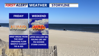


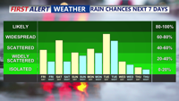


DELMARVA -- The cloudy and much cooler conditions continue the rest of Friday, along with a few showers. Warmer and more humid air builds into Delmarva this weekend with a daily chance of showers and storms.

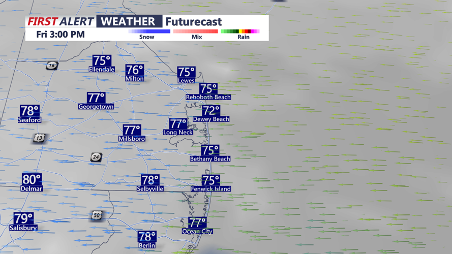
A cold front continues to sink southward, settling just below the Delmarva Peninsula, through this afternoon. This will keep much of Delmarva under an easterly flow, with a persistent deck of low clouds and temperatures in the mid to upper 70s along the coast. Some areas inland, particularly across the Eastern Shore of Maryland and far southern Delaware could reach 80 degrees. A few isolated showers or thunderstorms may develop, but the risk of severe weather or flooding remains low.

Friday night and into Saturday, the easterly flow will gradually give way to a southerly return flow as high pressure shifts east over the Atlantic. This will allow a warm front to lift northward on Saturday, ushering in a much warmer and increasingly humid air mass. Scattered showers and thunderstorms could develop Saturday afternoon, especially in northern and western parts of the peninsula. The Storm Prediction Center has a "Marginal" (1 of 5) risk for severe weather is in place, damaging winds being the primary threat.

A weak cold front will approach Saturday night and stall over the region on Sunday, bringing another round of scattered thunderstorms, primarily during the afternoon and early evening hours. Temperatures across southern Delmarva could climb near 90 degrees, with heat indices remaining below 100 due to slightly lower dew points on Sunday.

Looking ahead to Monday and Tuesday, an upper-level trough will amplify over the eastern U.S., helping to drive another cold front through the region by late Tuesday. This setup will bring increased instability and shear, opening the door for stronger thunderstorms Tuesday afternoon, some of which could become severe. Temperatures are expected to approach 90 degrees both days, with Tuesday shaping up as the hottest and most humid of the period.

By midweek, cooler and less humid air should begin to filter in as high pressure builds closer on Wednesday through the 4th of July. While an upper-level trough will remain nearby, the overall moisture content will be lower, keeping the chance for showers and storms minimal during the midweek stretch.