


DELMARVA - Sussex County is in for unsettled weather beginning Wednesday evening as a pair of cold fronts move through the region, bringing rounds of showers and thunderstorms before a significant cool-down Friday.
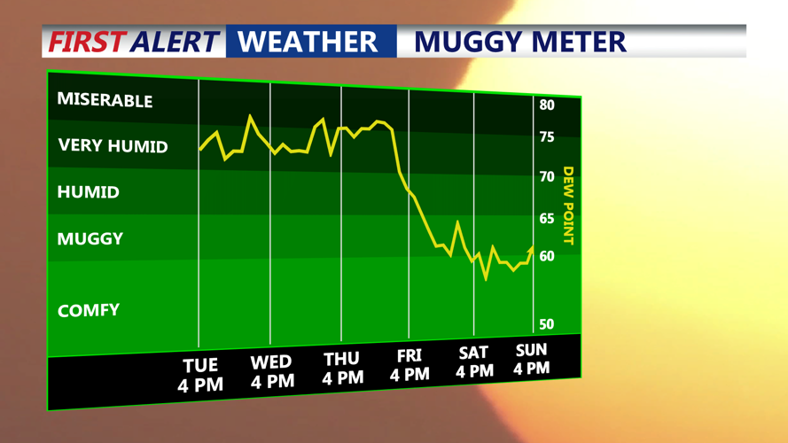
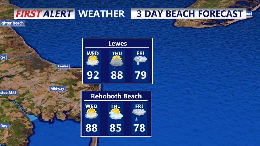
Wednesday evening will remain warm and muggy, with temperatures in the 90s inland and upper 80s along the coast. Scattered thunderstorms are expected late in the day and evening, bringing the risk of locally heavy rainfall and gusty winds before diminishing overnight.
Thursday will feature more clouds and slightly lower temperatures, but humidity will remain high. Heat index values will still approach 100 degrees ahead of another, stronger cold front moving in Thursday night. Showers and thunderstorms are likely to redevelop along the front, with rainfall totals between 1 and 3 inches possible. Localized flash flooding may occur.
By early Friday, cooler Canadian air will filter into Sussex County, dropping daytime highs into the upper 60s to low 70s — well below normal for late July. Conditions will gradually improve as high pressure builds, setting the stage for a pleasant, dry weekend with lower humidity.