


DELMARVA - A strong cold front will sweep across Sussex County late this afternoon and move offshore overnight, opening the door for arctic high pressure that will dominate the region through Tuesday. While the front is expected to pass through mainly dry, residents will notice a sharp temperature drop and increasing winds.
Gusts this afternoon and evening may reach between twenty-five and thirty-five miles per hour, making temperatures feel even colder as the front settles in. Overnight lows fall into the mid to upper twenties across Sussex County.
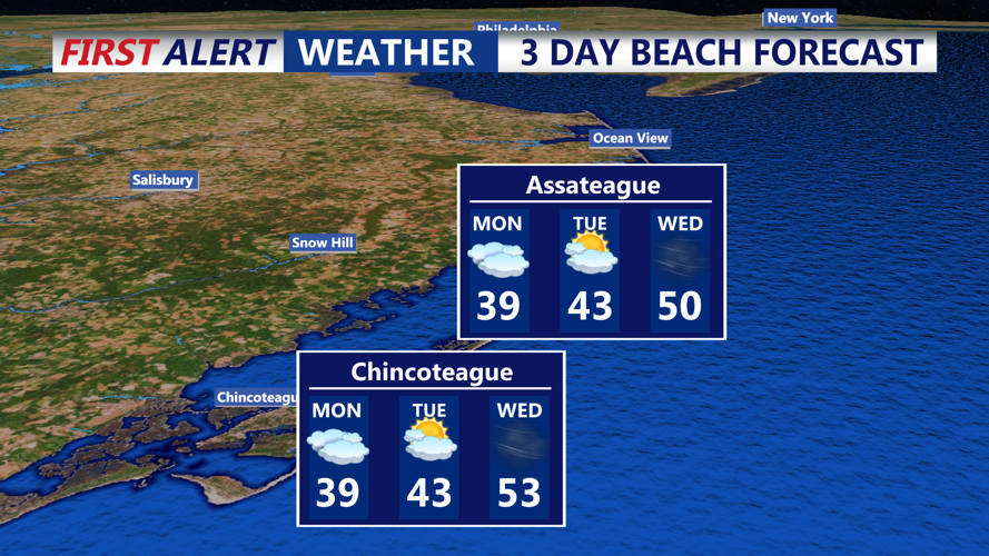
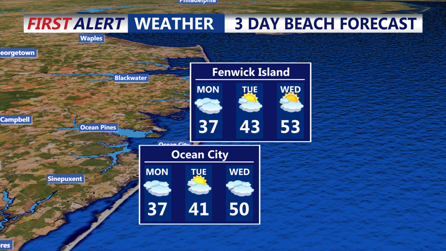
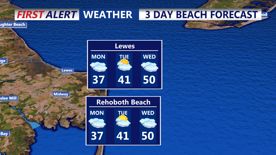
By Monday, high pressure building in from the Great Lakes will keep conditions dry and cold. Highs will struggle to reach the mid-thirties in Sussex County, with a mix of sun and clouds through the afternoon. A weak coastal low developing well to the south may bring light snow to parts of the lower Delmarva, but any precipitation is expected to remain south of Sussex County.
The coldest air of the season arrives Monday night into early Tuesday as skies partially clear and winds relax. Lows drop into the teens inland and lower twenties near the coast. Despite the frigid start, temperatures will gradually rebound Tuesday afternoon, reaching the upper thirties to near forty as light southwesterly flow returns.
Another storm system will approach midweek, bringing the next chance for rain or a wintry mix on Wednesday, followed by additional cold air late in the week.