


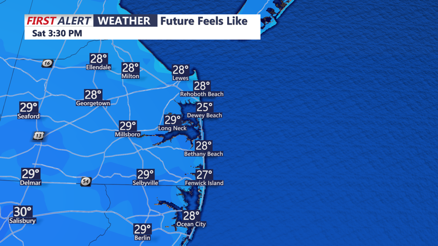


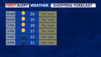


DELMARVA -- Grab some coffee or a hot chocolate! You'll need to bundle up today as a cold and windy conditions set the tone for the weekend. Highs are expected to reach the upper 30s to near 40, but brisk west-northwest winds gusting up to 30 mph will keep wind chills in the 20s throughout the day.

It will feel like it's in the 20s for the entire day.
Despite the chill, high pressure should keep skies mostly sunny and the weather dry.

Small business Saturday, winter-like feel despite sunshine.
By Saturday night, high pressure will remain in control, providing calm conditions as it shifts southward. Lows will dip into the 20s, making for a frosty start Sunday morning.
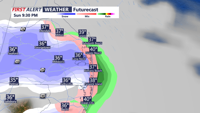
Sunday will bring slightly milder temperatures, with highs climbing to the mid-40s under a mix of sun and clouds. However, a weak disturbance moving through the region overnight may clip parts of Delaware and eastern Maryland, potentially bringing light rain or snow showers. While temperatures will be cold enough for snow to develop, any accumulation is expected to be minimal.

Brief snow showers are possible Sunday Night, no accumulation is expected.
As the system moves out Monday, a cold northwest flow will settle over the area, keeping temperatures below normal into Tuesday. A brief warm-up is possible midweek as a weak warm front approaches, but another stronger system Wednesday night may bring a mix of rain and snow showers to the region.
This stronger system could produce Delmarva’s first light snow of the season, though details remain uncertain. It's associated with an Alberta Clipper. Once it moves through, another reinforcing shot of cold northwest winds will end the week with below-normal temperatures.

Well below average temperatures are expected through the extended forecast.