



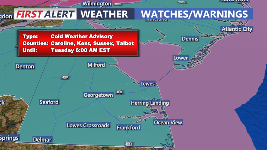

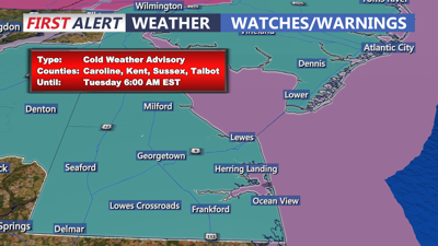
DELMARVA -- A blast of arctic air will settle over the region beginning Monday evening, bringing dangerously cold temperatures and strong winds. The National Weather Service has issued a Cold Weather Advisory effective through Tuesday morning, warning of wind chills as low as 5 below zero.

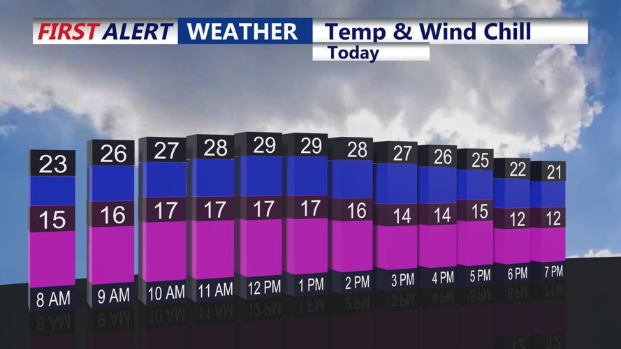
Will feel like the teens all day, then single digits by the evening.
Highs today are expected to remain in the mid to upper 20s, but brisk northwest winds gusting up to 25 mph will make it feel like the teens. By Monday night, temperatures will plummet further, with lows in the single digits across much of Delmarva.
Tuesday will continue the trend of frigid weather, with daytime highs struggling to reach the low 20s. Winds will ease slightly but could still gust up to 15 mph, adding to the bitter cold.

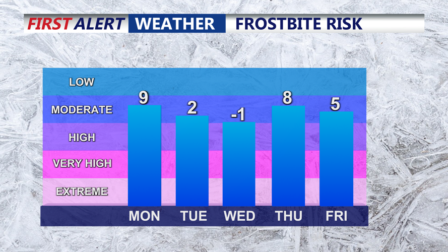
Frostbite risk will be high Tuesday-Wednesday
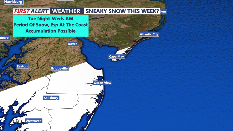
An arctic high-pressure system will dominate the region early in the week, but a developing low-pressure system offshore could bring light snow to coastal areas of Delmarva late Tuesday night into Wednesday morning. Forecast models remain uncertain, with some showing the system staying offshore and others suggesting light snow accumulation near the coast.

System passing to our south my spread a period of snow into the area Tues Night.
High pressure will return by Wednesday, bringing quiet but cold conditions. Temperatures will begin to moderate on Thursday, with highs in the upper teens to upper 20s. A gradual warming trend is expected to continue into the weekend, with highs climbing above freezing by Saturday.
While the first half of the week will be defined by dangerous cold, Thursday and Friday may bring a slight chance of snow as another system tracks through the region. However, significant accumulation is unlikely at this time.
Take precautions against the cold, including dressing in layers, protecting exposed skin, and checking on vulnerable neighbors and pets.
