


DELMARVA - Monday night, Delmarva will experience the effects of a disturbance moving through the area. This system will bring a few isolated showers and thunderstorms, particularly in the southeastern parts of the region, during the late afternoon and early evening hours. As the sun sets, any lingering storms will gradually dissipate, leading to partly cloudy skies overnight. Temperatures will drop into the upper 60s to low 70s, providing a cool and comfortable night.
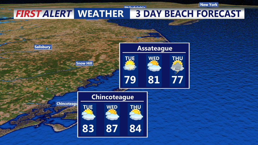
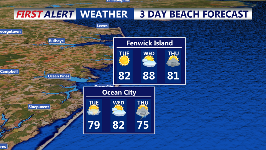
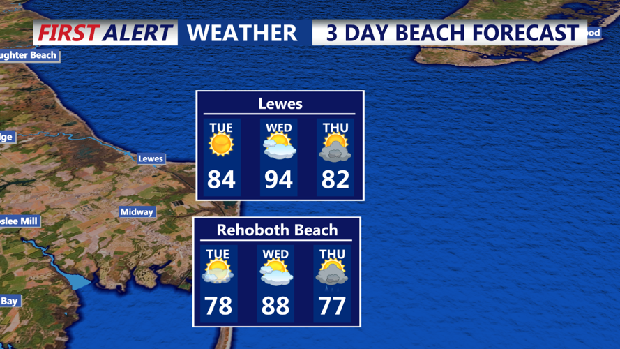
By Tuesday morning, high pressure will begin to reassert itself over Delmarva, bringing more stable and cooler conditions. Morning temperatures will start in the mid-60s under mostly clear skies. As the day progresses, expect abundant sunshine with only a few passing clouds. Afternoon temperatures will rise to the mid-80s, making it a warm but pleasant day with lower humidity levels compared to the previous day.
Tuesday evening will remain calm and clear, with temperatures gradually cooling into the mid-70s as the sun sets. This serene weather will set the stage for a quiet night, allowing residents to enjoy a peaceful end to the day.
Looking ahead, a cold front is expected to approach the region on Wednesday, which could bring another round of showers and thunderstorms to Delmarva late in the day. However, for now, Tuesday offers a brief respite with pleasant weather across the area.