


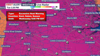
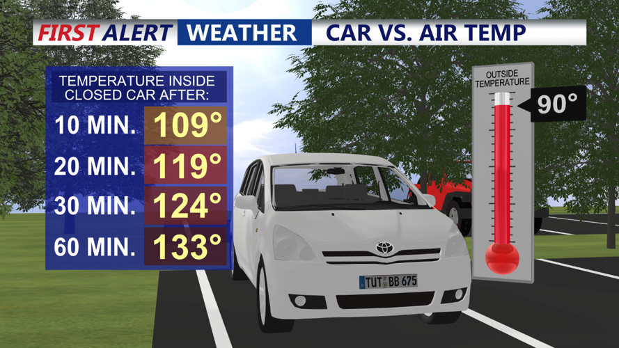
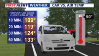

DELMARVA - Hot and humid conditions will persist with high temperatures in the low to mid-90s and heat index values ranging from 100 to 110 degrees in most areas. Somewhat lower heat index values are expected in the far northwest due to arriving cloud cover.
Showers and thunderstorms are likely throughout the day and into the night, as the transition to cooler weather begins. The Storm Prediction Center has placed most of the region in a Slight Risk (2 out of 5) for severe weather. The main threats include damaging winds and heavy rain, with a smaller risk of large hail. Severe weather parameters, including CAPE and shear, will support the potential for strong storms. Prepare for another day of eventful weather.
Wednesday Night: Showers and thunderstorms will continue into the night, gradually tapering off by Thursday morning. Humidity levels will start to decrease overnight, providing some relief.
Thursday: Thursday will bring a welcome break from the extreme heat, with lower humidity and more normal temperatures. There will still be a chance of showers and thunderstorms in the eastern and southeastern areas during the morning, but conditions will improve throughout the day.
Long Term (Friday through Monday): The thickest of the heat and humidity will have moved away, providing the region with a break. While this is the warmest part of the year climatologically, with highs mostly in the mid to upper 80s, the lower humidity levels will make the air feel more comfortable. Heat headlines will not be required during this period.
These changes are due to the relaxation of the upper high to the east/southeast and the arrival of a weak upper trough in the Northeast and northern Mid-Atlantic areas. There are indications that the upper ridge may return beyond next Tuesday or Wednesday, hopefully with a less powerful impact.