


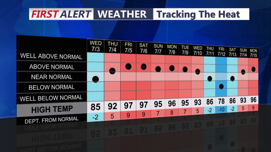


DELMARVA - A Bermuda high pressure system continues to dominate, bringing dangerously hot and humid air into the region. High temperatures will soar well into the 90s, reaching around 100 degrees along the I-95 corridor and into Delmarva.
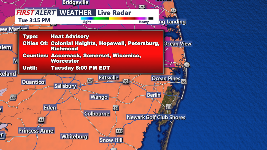
Surface dew points will start in the low to mid-70s but will drop back to the upper 60s to low 70s as southwest winds increase to 10-15 mph, with gusts up to 25 mph. Despite this, the heat index values will remain high, ranging from 100 to 110 degrees. Heat Advisories and Excessive Heat Warnings are in effect for all but the coastal strip of New Jersey.
Strong shortwave energy along with a thermal trough will approach from the west by Tuesday afternoon and a slight Risk (2 out of 5) for severe thunderstorms this afternoon and evening. Expect thunderstorms to move into the region late in the afternoon, bringing damaging wind gusts, heavy rain, frequent cloud-to-ground lightning, and possible hail.
Showers and thunderstorms will taper off by midnight. The night will remain warm and humid, with lows in the 70s, barely dropping below 80 in and around Philadelphia.
Wednesday Morning through Afternoon: Wednesday will see temperatures slightly cooler but still warm, with highs in the mid to upper 80s. Humidity levels will remain high, contributing to uncomfortable conditions throughout the day. Expect partly cloudy skies with a chance of isolated thunderstorms in the afternoon. Southwest winds will persist at 10-15 mph, providing little relief from the humidity.
Stay hydrated and take frequent breaks if spending time outdoors. Monitor local weather updates for any changes to the forecast or additional warnings.
