


DELMARVA - Late Sunday evening into Tuesday evening will see Sussex County caught between a decaying cold front and building influences from both high pressure to the north and low pressure to the south.
Tonight, expect the remnants of the cold front to bring a chance of light sprinkles or an isolated shower as it pushes through. Humidity will be elevated for mid-September, with dew points in the 50s to low 60s, while skies may clear somewhat overnight, especially in southern zones. Where skies lighten, patchy fog could form; more persistent clouds associated with the incoming southern low will limit widespread fog elsewhere. Lows should fall into the upper 50s to low 60s.
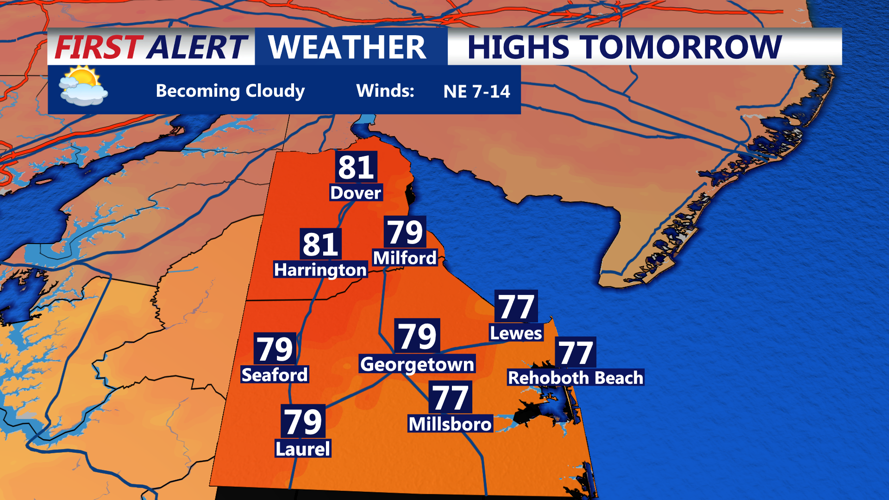
Monday will be warm and muggy. Clouds will gradually increase from south to north as the low pressure system lifts toward the Mid-Atlantic. Highs expected in the 70s to low 80s, cooler near the coast, with dew points rising into the lower 60s.
Monday night through Tuesday evening will bring mostly unsettled weather. A coastal system developing off the Carolinas will meander toward the region, bringing period(s) of showers especially across southern Delaware and Delmarva, with possible thunderstorms late Monday into Tuesday. Rainfall amounts could approach around an inch in southern parts of the county, while north-western areas may see lighter amounts, closer to a quarter-inch. Winds at the shore will pick up, with speeds of 15-25 mph and gusts up to about 30 mph as the low deepens and moves closer.