



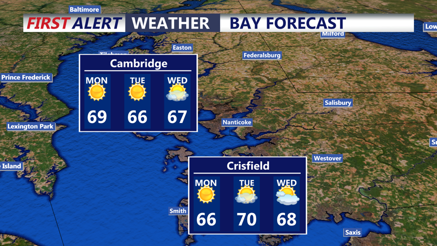
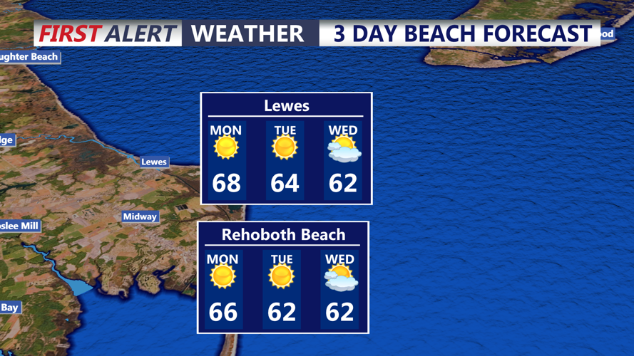

DELMARVA - A chilly start to Monday will give way to a sunny and milder afternoon across Delmarva and coastal communities from Lewes and Rehoboth Beach south to Fenwick Island and Ocean City, Maryland, as high pressure continues to influence the region.
A Frost Advisory was issued until 9 a.m. Monday. Early morning temperatures will range from the mid-30s to lower 40s, with the greatest potential for frost in inland communities including Georgetown, Millsboro, Seaford, Laurel, and Salisbury.
Residents should take precautions to protect sensitive outdoor plants and vegetation from frost damage.
Some patchy ground fog could also develop around sunrise, especially in rural and low-lying areas. Any fog should dissipate quickly as sunshine warms the region.
By Monday afternoon, temperatures will climb into the lower to middle 60s. Coastal communities, including Rehoboth Beach, Bethany Beach, Fenwick Island, and Ocean City, may experience slightly cooler conditions because of the nearby Atlantic Ocean.
Skies will remain mostly sunny throughout the day, with west to northwest winds generally between 5 and 12 mph.
Monday evening will bring continued dry conditions as temperatures gradually fall under mostly clear skies. A weak cold front will move across the Delmarva Peninsula overnight into early Tuesday morning, but little moisture is available to produce rainfall.
Overnight temperatures are expected to settle into the 40s, with some inland locations potentially dipping into the upper 30s by early Tuesday.
For coastal residents and boaters, marine conditions will remain relatively manageable Monday, with west to southwest winds around 12 to 17 mph and ocean seas of 2 to 3 feet. Conditions could become somewhat rougher Tuesday as northeast winds increase, with occasional gusts approaching 29 mph and seas building to 3 to 5 feet.
Looking ahead, high pressure will remain the dominant weather feature through the week, keeping conditions predominantly sunny and dry. High temperatures will generally remain in the 60s through Wednesday before a more substantial warming trend develops Thursday through the weekend.
Afternoon highs could reach the upper 60s to middle 70s by the end of the week, providing a stretch of above-normal temperatures heading into early November.
