



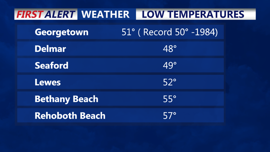
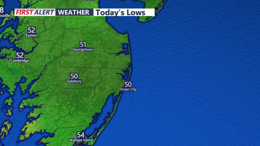

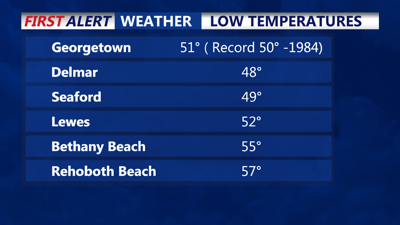
DELMARVA - It was yet another chilly start to the day on the Delmarva peninsula as we saw morning lows in the upper 40s to low 50s. Georgetown came to within one degree of tying the record low of 50 degrees set back in 1984. Yesterday our morning low of 53 degrees was the coolest August temperature since 8/8/2004.

We can expect another cool and clear day as high pressure remains in control across the region. Temperatures will stay below normal today, with highs in the mid to upper 70s across most of the area, some inland areas my hit 80 degrees. Thursday night will be clear and cool again, with lows ranging in the low to mid-50s across Delmarva.
As we move into Friday and the weekend, the high-pressure system will gradually shift offshore, allowing temperatures to return to more typical late August levels. Highs on Friday will climb into the low 80s, with even warmer conditions expected on Saturday as temperatures rise into the mid-80s. Overnight lows will also moderate, with temperatures in the mid to upper 50s Friday night and near 60 degrees on Saturday night. Skies will remain mostly clear, with some afternoon clouds developing along with light winds and sea breezes.
Looking ahead to early next week, an approaching trough will bring increased chances for showers and thunderstorms, especially on Monday and Monday night. While the exact timing and intensity of these storms are still uncertain, residents should be prepared for a shift towards more unsettled weather as the new week begins.
