



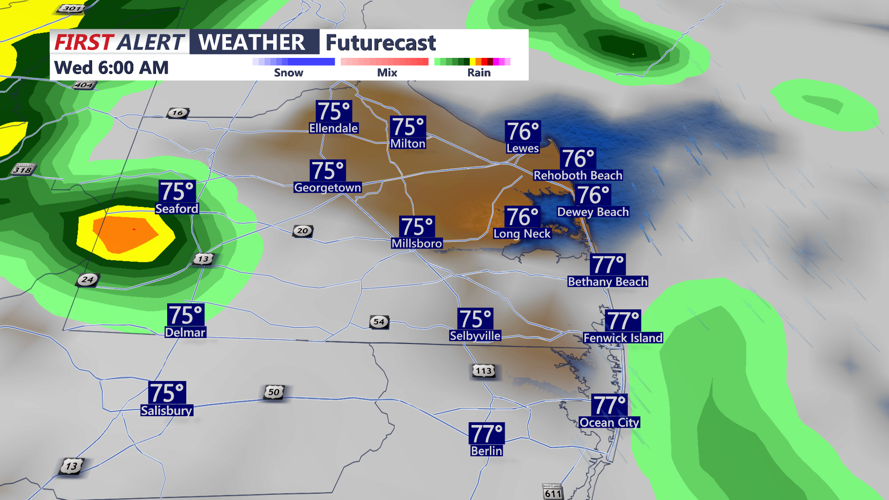

DELMARVA - Conditions are changing this morning as low pressure to the south pushes a warm front northward across the peninsula. A few showers, even a thunderstorm are possible this morning with warm and muggy conditions.

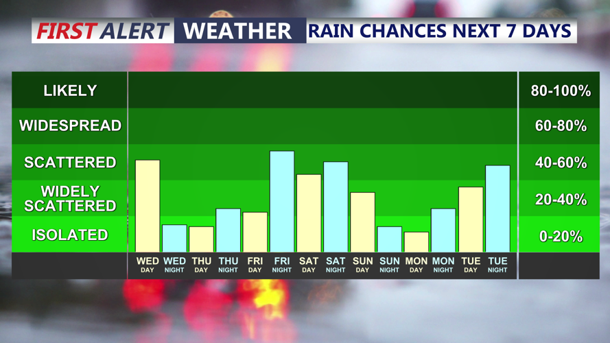
Periods of rain and thunderstorms will remain possible Wednesday afternoon and evening. The atmosphere will become increasingly humid, allowing some storms to produce drenching downpours. An additional one-half inch to 1 inch of rain may fall in some locations.

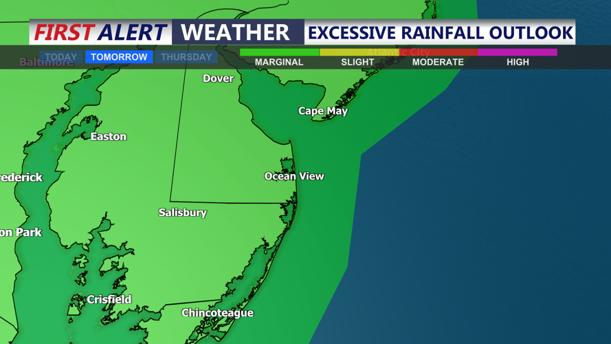
Delmarva is under a marginal risk for excessive rainfall today. Localized flooding could develop in communities that receive repeated downpours, but widespread severe weather is not expected because winds throughout the atmosphere will remain relatively weak. High temperatures today in the mid to upper 80s.
Hot and humid weather will build during the second half of the week as winds turn southwesterly. Friday and Saturday are expected to be the hottest days, with inland highs approaching the lower 90s and somewhat cooler temperatures along the coast.
Dew points could climb into the middle 70s, creating heat index values near or above 100 degrees in parts of Delmarva. While uncomfortable and potentially dangerous during extended outdoor activity, the heat is not expected to be as extreme as the early July heat wave.

Scattered thunderstorms will remain possible each afternoon and evening through the weekend. Any stronger storm could produce damaging wind gusts, frequent lightning, heavy rainfall and localized flooding, although no single day currently appears to carry an unusually high severe-weather threat.
