


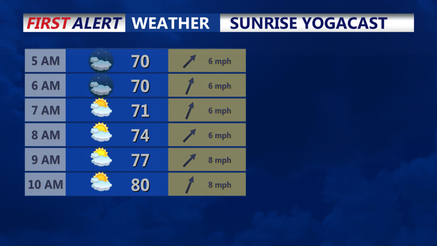


DELMARVA - Wednesday morning will start warm and muggy across Delmarva, with temperatures quickly rising from the low 70s into the 80s by mid-morning. Expect partly cloudy skies and increasing humidity as southwest winds bring in warmer air throughout the morning hours.
By the afternoon, temperatures will peak in the low to mid-90s, with heat indices making it feel closer to the upper 90s. While the main focus of the Excessive Heat Warning is further north, residents in Delmarva should still take precautions against the heat and humidity. Hydration and avoiding prolonged exposure to the sun are advisable, especially during the hottest part of the day. As the cold front approaches, there's a slight chance of thundershowers developing in the late afternoon. However, the overall threat for severe weather is lower than initially expected, with only a marginal risk of isolated strong wind gusts from any potential storms.
During the evening, the cold front will continue its approach, which could trigger isolated thunderstorms. The risk of severe weather remains low, but residents should remain aware of any changing conditions. It will remain warm and humid into the night, with temperatures dropping only into the mid-70s by early Thursday morning.
As the front pushes through overnight into Thursday morning, expect a mix of clouds and possibly some lingering showers before dawn. Temperatures will settle into the low 70s, offering a brief break from the intense heat that dominated Wednesday.
