


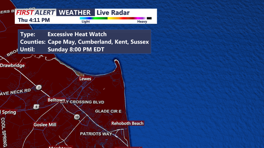


DELMARVA - The short-term forecast for Delmarva indicates a weekend dominated by hot and stormy weather. An Excessive Heat Watch remains in effect for both Saturday and Sunday, with no significant changes at this time.
A cold frontal boundary over or just north of the region on Friday night is expected to stall. By Saturday into Sunday, this boundary is predicted to lift northwards as a warm front, bringing even warmer air into the region. On Sunday, a cold front from the northwest will approach but isn't expected to pass through until around Monday.
Given the synoptic situation, a hot and stormy pattern will take hold for the weekend. Showers and thunderstorms are likely to continue into Friday night due to the stalling front and some shortwave energy. The greatest potential for thunderstorms will be in the evening, tapering off overnight. The Storm Prediction Center (SPC) has placed our northern and northwestern areas under a MARGINAL risk for severe weather, with gusty winds being the primary concern. Patchy fog could develop across the region overnight into the morning, especially in areas that previously experienced showers and thunderstorms.
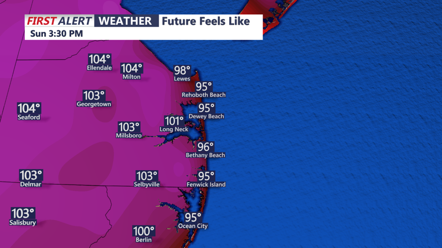
From Saturday through Sunday, strong warm air advection will bring the region the warmest temperatures of the ongoing heat wave. Interior areas and the I-95 corridor could see temperatures in the mid to upper 90s on Saturday, with Sunday being even warmer by 2-4 degrees. The greatest chance for hitting Excessive Heat Warning criteria will be on Sunday. Despite the stormy forecast, clouds and showers/thunderstorms could prevent heat index values from reaching the necessary levels for a warning. Showers and thunderstorms are possible again on Saturday afternoon and evening, though mainly sub-severe conditions are expected at this point.
There is growing concern for severe weather from Sunday afternoon into Sunday night with the approach of a stronger cold front. Currently, the SPC does not have our region outlook for any severe weather potential during this timeframe.
Residents and visitors in Sussex County and the Sussex County beaches should prepare for extremely hot and potentially stormy conditions. Stay hydrated, take breaks in air-conditioned environments, and keep an eye on weather updates throughout the weekend.