


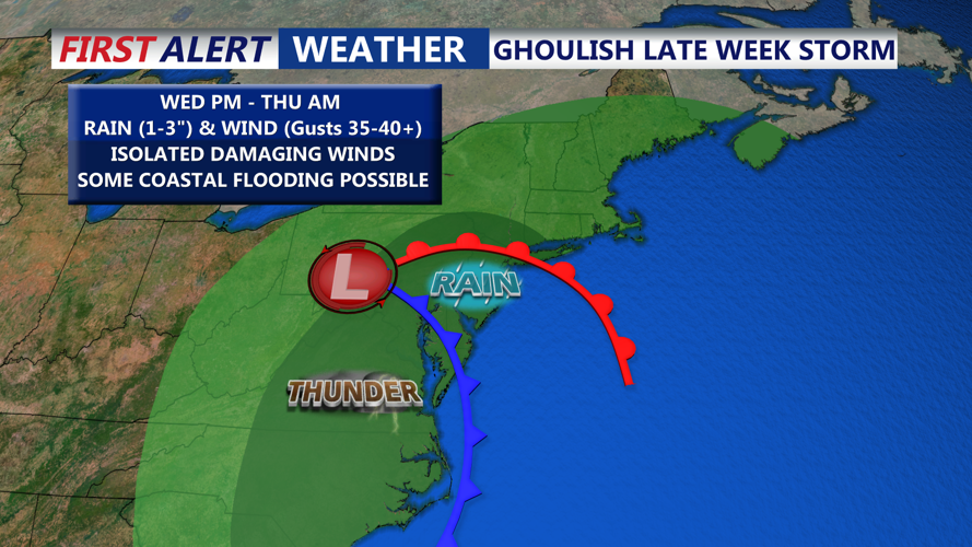


DELMARVA -- A low pressure system will form to the south of Delmarva, passing near or just to our west by Thursday night, pushing a cold front through the region.

This morning expect lots of clouds and winds with temperatures upper 40s to low 50s. Scattered showers are likely as the offshore low tracks eastward.

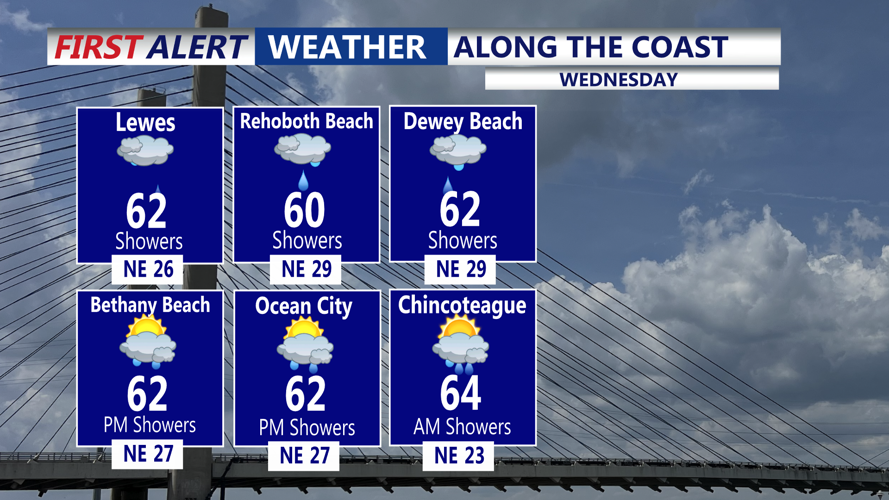
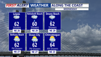
During the day, the coastal system will linger off the North Carolina and Virginia coasts while another stronger low approaches from the west. Winds will remain brisk out of the northeast at 25 to 35 mph along the coast, with gusts of 20 to 30 mph inland. Temperatures will again climb into the upper 50s and low 60s under mostly cloudy skies and isolated showers.

Late Wednesday into Thursday, both systems are expected to merge, bringing a period of moderate to heavy rain across Delmarva. We have issued a YELLOW ALERT for Thursday morning. Current forecasts suggest widespread totals between one and three inches, though flooding concerns remain minimal given recent dry conditions. Still, some localized ponding or poor drainage flooding is possible.

A marginal risk for excessive rainfall is in place across much of the area. Should the system track slightly westward, there could be a low-end threat for stronger storms, given elevated wind shear and limited instability, a setup that could produce isolated strong wind gusts or rotating cells.
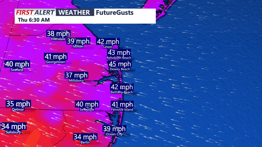
Rain tapers off Thursday night as the system exits and a cold front sweeps through. Behind it, winds will strengthen for the trick or treaters on Halloween, with gusts up to 40 mph and highs in the upper 50s to low 60s.
The weekend looks quieter and cooler as high pressure builds in. Mostly dry conditions are expected through Sunday, though chilly overnight lows could bring a risk of patchy frost in some inland areas where the growing season continues. A weak front may approach late Sunday or early Monday, potentially bringing another round of scattered showers.
