


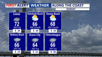


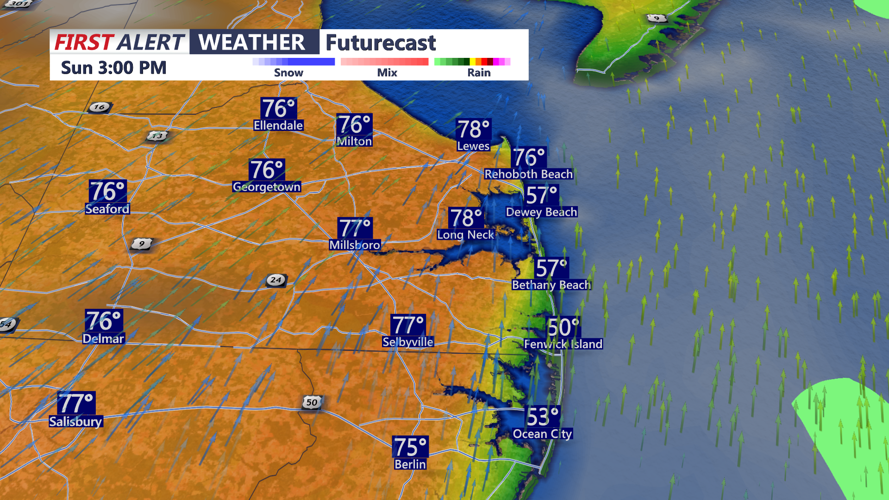
DELMARVA - Under mostly sunny skies this afternoon, temperatures are surging with inland spots reaching the mid and even upper 70s. It will stay cooler near the coast, where highs should remain in the 50s and 60s.
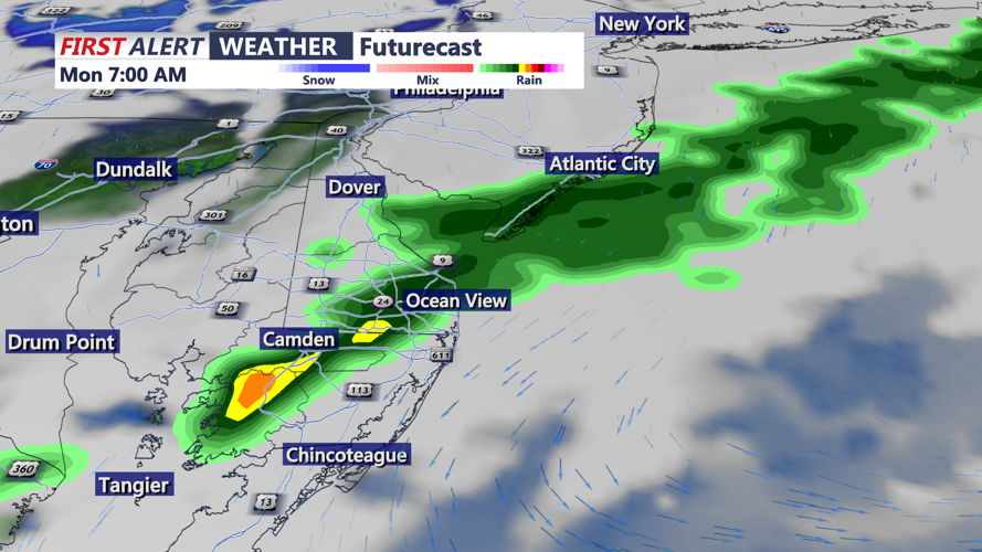
Lovely Sunday afternoon, showers early Monday and cooler
-
btrihy
Meteorologist
Meteorologist Bob Trihy joined CoastTV in 2023. He grew up in Great River on Long Island, N.Y. Bob caught the weather bug when he was around eight years old and tracked storms up and down the east coast. He witnessed some big ones, like the blizzard of 1978, as well as tropical systems.
