


DELMARVA - More clouds than sun for Sunday and chilly. Then much colder early next week.

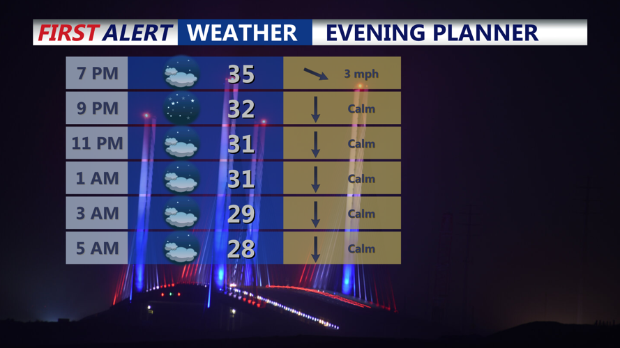
For this evening expect variable clouds with a peek at starry skies at times. Temperatures quickly dip through the 30s. There could be some patchy fog in spots overnight, and that could cause slick roads and bridge decks into Sunday morning as lows dip into the 20s to near 30.

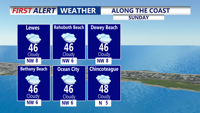
Sunday will once again be mainly cloudy with highs in the mid 40s. A cold front will sweep across the region late Sunday into Sunday night. Moisture looks limited, but northern areas of the wider Mid-Atlantic have a 20–30% chance for light snow along the frontal passage, little to no impact is expected for Delmarva.

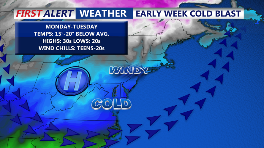
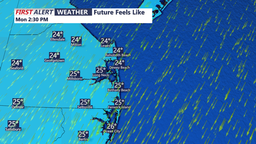
Much colder air moves in Monday and Monday night, with temperatures running as much as 20 degrees below normal. Highs only in the 30s Monday and Tuesday. Forecast lows Monday night may trend even colder if skies remain clear and winds stay light under nearby high pressure, setting up efficient radiational cooling. Feels like temperatures will be in the teens and 20s early in the week.

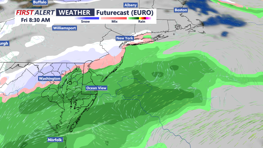
Another low pressure system is expected to approach Wednesday into Thursday as the upper-level pattern reshuffles over eastern Canada and the Great Lakes. Forecast models are showing low chances of precipitation. A stronger clipper-like system could bring a cold rain, and possibly some snowflakes on Friday. Accumulating snow is not expected.

Another blast of arctic air moves in next weekend with highs in the 30s and lows in the 20s and remaining dry.
